 |
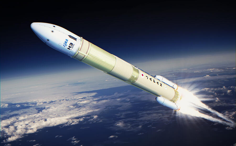
Launch of the H3 Launch Vehicle with HTV-X Cargo Spacecraft |
Japan to put hypersonic missile-tracking technology to the test in space | South China Morning Post
Japan Deploys Orbital Hypersonic Tracking Experiment as Regional Threat Detection Race Intensifies
Ministry of Defence infrared payload aboard HTV-X cargo craft marks Tokyo's entry into contested space-based missile warning domain
TOKYO — Japan's Ministry of Defence has quietly deployed experimental infrared tracking sensors aboard the newly arrived HTV-X cargo spacecraft in what officials describe as a critical pathfinder for indigenous space-based hypersonic missile detection capabilities, adding a new player to an increasingly competitive orbital surveillance architecture.
The HTV-X, launched Oct. 26 from Tanegashima Space Center aboard an H3 rocket and captured by the International Space Station's robotic arm Oct. 30, carries more than the 4.4 metric tons of routine logistics supplies. Embedded within the mission are Ministry of Defence infrared sensors designed to detect and track hypersonic glide vehicles exceeding Mach 5—a capability that has proven elusive even for established space powers.
The ¥3.8 billion ($24.7 million) experiment represents Japan's first operational foray into space-based missile tracking, coming as China's DF-17, Russia's Avangard, and North Korea's Hwasong-series hypersonic systems proliferate across the Indo-Pacific. Ministry officials confirmed the spacecraft will conduct tracking trials against simulated hypersonic targets during its extended 18-month post-ISS free-flight phase, with successful demonstration potentially leading to dedicated satellite deployment.
The Hypersonic Tracking Problem
The fundamental challenge in hypersonic tracking has less to do with detection physics than with maintaining custody of highly maneuverable targets.
When hypersonic vehicles exceed Mach 5, atmospheric friction raises nose cone and leading edge temperatures to 3,000-5,000°F, generating intense infrared signatures. However, distinguishing these signatures against Earth's thermal background has been compared to identifying a slightly brighter candle in a sea of candles.
Radar tracking presents frequency-dependent challenges. Lower-frequency systems—HF, UHF, and S-band—suffer significant attenuation from the plasma sheath enveloping hypersonic vehicles. X-band (8-12 GHz) and higher-frequency radars including Ku-band, Ka-band, and millimeter-wave systems penetrate the plasma more effectively, but face a different constraint: update rate.
Traditional ballistic missiles follow predictable parabolic trajectories amenable to Kalman filtering with relatively sparse radar updates. Hypersonic glide vehicles execute sustained aerodynamic maneuvers throughout flight, demanding dramatically higher update rates to maintain track custody. Ground-based radars additionally face line-of-sight limitations against low-altitude, maneuvering targets—the classic "radar horizon" problem that becomes acute when seconds matter.
This has driven the architecture toward persistent infrared surveillance from space, where continuous thermal tracking compensates for unpredictable kinematics.
U.S. SBIRS: The Baseline Capability
The U.S. Space-Based Infrared System, operational since 2011, established the current state-of-practice for orbital missile warning. Operating from geosynchronous orbit at 22,000 miles altitude, SBIRS provides continuous hemispheric surveillance, scanning Earth's surface every 10 seconds for infrared activity. The system detects missile launches faster than any alternative while determining missile type, burnout velocity, trajectory, and probable impact point.
SBIRS satellites carry two distinct infrared sensors: a scanning sensor providing 24/7 global coverage, and a step-staring sensor with precision pointing for theater missions. Operating in short-wave and mid-wave infrared bands, the sensors detect any significant thermal event globally.
However, SBIRS was optimized for traditional ballistic missiles. China and Russia are fielding hypersonic, low-flying missiles that produce infrared signatures 10-20 times dimmer than ballistic threats—signatures the current architecture struggles to maintain custody of beyond boost phase.
The geometry compounds the problem. GEO-based satellites provide persistent stare coverage for boost-phase detection while monitoring theater ballistic missile events, but were never designed to continuously track maneuvering, very-low-altitude hypersonic warheads after booster separation.
The LEO Proliferation Strategy
Recognizing GEO's limitations, the U.S. Space Development Agency has pivoted to proliferated low Earth orbit constellations operating below 2,000 km altitude.
In lower orbits, sensors detect dimmer signatures than higher-altitude systems can resolve. Crucially, LEO systems maintain visibility of hypersonic glide vehicles as they maneuver and generate atmospheric friction heating.
The architecture exploits geometric diversity: multiple satellites detecting a given engagement provide different look angles enabling accurate three-dimensional tracking. Twenty-eight satellites launched in 2024-2025 form the initial tracking kernel.
SDA intends to field at least 1,000 satellites in LEO by 2026 as part of its Proliferated Warfighter Space Architecture. The Space Force requested nearly $16 billion over five years for these capabilities, with L3Harris Technologies, Northrop Grumman, Raytheon Technologies, and SpaceX contracted for the Tracking Layer.
The proliferated approach fundamentally changes the defensive economics. With hundreds of satellites distributing the surveillance function, the cost to attack the constellation exceeds the replacement cost—the defensive bullet now costs more than the satellite.
Sensor Fusion Architecture
Effective hypersonic defense requires comprehensive sensor fusion combining space-based radar and infrared optical sensors. Infrared excels at target acquisition; space-based radar provides trajectory tracking. High-speed processing enables continuous fusion—when radar loses track, infrared assists reacquisition.
Multispectral electro-optical/infrared sensor suites spanning ultraviolet to long-wavelength infrared, with extremely low background noise performance, serve as optimal surveillance augmentation for hypersonic missile defense detection and tracking.
Space-based infrared networks easily cover Earth's entire surface, making them ideal for early warning. Current sensor technology, however, lacks the precision required for interception fire control, positioning these systems as complements to radar rather than replacements.
L3Harris Technologies has advanced multiple orbital layers for the integrated architecture. The company completed preliminary design review for infrared payloads destined for the Missile Track Custody constellation in medium Earth orbit and successfully launched five tracking satellites in February 2024 for the Hypersonic and Ballistic Tracking Space Sensor program.
Next-Gen OPIR: The GEO Evolution
The Space Force's Next-Generation Overhead Persistent Infrared program represents the planned SBIRS succession, with first GEO launches now scheduled for March 2026. Next-Gen OPIR sensors deliver three times the sensitivity and twice the accuracy of SBIRS, specifically designed to detect faster-burning, dimmer missile boost technologies.
Operating from 22,000-mile GEO vantage points, Next-Gen OPIR satellites maintain unmatched mid-latitude coverage for ballistic missiles, hypersonics, and emerging threats. The satellites employ Lockheed Martin's LM 2100 combat bus with enhanced resiliency features addressing counter-space threats.
Next-Gen OPIR provides downlink data rates four times greater than SBIRS. Data collected during initial attack phases cues sensors in other orbital layers for continuous tracking through post-boost and mid-course flight.
The architecture aims for multiple fields of view over designated regions without deploying massive GEO constellations. Next-Gen OPIR works in tandem with SBIRS, future Next-Gen OPIR Polar satellites, and SDA's LEO tracking layer in a seamless, resilient, multi-layered national missile warning and defense architecture.
HTV-X: Japan's Experimental Platform
The HTV-X represents more than incremental cargo vehicle improvement. After completing its three-month ISS berthing, the spacecraft operates as an on-orbit experimental platform for up to 18 months—extended mission capability distinguishing it from the predecessor HTV, which typically remained ISS-attached for only one month.
Performance improvements include cargo loading time reduced from 80 to 24 hours, power generation increased five-fold to 1 kilowatt via two solar arrays, and payload capacity reaching 5,820 kg using International Standard Payload Racks.
Mitsubishi Heavy Industries built the spacecraft with several technology demonstrations beyond the defense sensors: H-SSOD small satellite deployment mechanism, Mt. FUJI laser-based attitude measurement experiments, DELIGHT deployable lightweight planar antenna demonstrations, and SDX next-generation solar cell tests.
Japanese media reports indicate a projectile simulating a hypersonic missile will be launched during the experimental phase to evaluate the infrared sensors' tracking performance from orbit. Successful demonstration would validate the sensor suite for integration into dedicated surveillance satellites, providing Japan with persistent early-warning independent of ally-provided data.
Regional Threat Proliferation
Hypersonic weapons travel at approximately 3,900 mph—twice bullet muzzle velocity—while executing mid-flight maneuvers that defeat traditional missile defense architectures. Former Missile Defense Agency officials note these weapons fly at lower altitudes than ballistic missiles, exploiting line-of-sight limitations of ground-based radars.
China's DF-17 achieved initial operating capability by 2019, providing the People's Liberation Army Rocket Force with a medium-range hypersonic strike option. Russia's Avangard system entered service in 2019, carried by UR-100N ICBMs. North Korea conducted test launches of the Hwasong-8 in September 2021 and Hwasong-16B in January 2022, though the reliability and operational status of these systems remains subject to debate among Western intelligence analysts.
Japan's Acquisition, Technology & Logistics Agency has pursued the Hyper-Velocity Gliding Projectile program since 2018, focusing on "island defense" scenarios where rapid response to amphibious or expeditionary threats requires standoff strike capability. The HVGP aims for deployment in the late 2020s.
The broader context includes Japan's 2022 National Security Strategy revision, which authorized counter-strike capabilities for the first time since World War II. Space-based persistent tracking enables responsive strike operations by providing continuous target updates—the kill chain closes only with maintained custody.
Technical Challenges Ahead
Hypersonic weapons shift the offense-defense balance toward offense dominance in near-peer competition, with significant implications for crisis stability. The combination of speed, maneuverability, and flight altitude compounds defensive challenges.
Early missile detection proves particularly critical for hypersonic glide vehicles, where speed combined with low-altitude flight makes the radar horizon problem acute. Space-based infrared sensors offer persistent surveillance over wide areas, detecting launch thermal signatures and tracking weapons throughout flight, buying critical additional minutes for defensive response.
Japan's experiment will inform not only indigenous satellite development but contribute valuable data on optimal infrared wavelengths, signal processing algorithms, and sensor sensitivity requirements for hypersonic tracking from LEO. The Ministry of Defence has not disclosed specific technical parameters, though industry sources suggest the sensors operate in multiple infrared bands with enhanced signal-to-noise ratios compared to commercial Earth observation systems.
Whether Japan proceeds with a dedicated constellation or contributes sensors to a multilateral tracking network remains unclear. Ministry officials have discussed potential cooperation with the United States on integrated early warning, while maintaining sovereign capability as a hedge against alliance friction.
The Orbital Economics
The U.S. military is constructing a robust constellation across GEO, HEO, MEO, and LEO. This multilayer architecture rapidly detects, accurately tracks, and precisely targets threats—particularly hypersonic vehicles that elude traditional defenses.
Average satellite costs vary dramatically by orbit. SDA's LEO tracking satellites average $14-15 million per spacecraft, while Next-Gen OPIR GEO satellites approach $2 billion including development amortization. The proliferated LEO approach sacrifices individual sensor capability for aggregate coverage and survivability.
Japan's decision point centers on whether to pursue a small number of exquisite GEO sensors providing theater coverage, or contribute to a proliferated LEO architecture with international partners. Budget realities favor the latter—Japan's space program operates under fiscal constraints that make multi-billion-dollar flagship programs increasingly difficult to justify.
The HTV-X experiment provides empirical data informing this choice. Successful tracking demonstration from LEO would validate the technical approach while revealing operational limitations. Conversely, poor signal-to-noise ratios or inadequate custody maintenance would argue for higher-orbit systems despite their greater vulnerability.
Looking Forward
As HTV-X begins its extended experimental mission, the next 18 months will prove whether Japan's approach to hypersonic threat detection provides actionable early warning in operationally relevant scenarios. The spacecraft's successful deployment contributes to international understanding of space-based missile tracking while advancing Japan's indigenous capabilities.
The experiment occurs against accelerating regional arms competition. China's defense industrial base produces hypersonic systems at scale, while Russia continues development despite Ukraine war distractions. North Korea's programs, while less mature, demonstrate sustained commitment to asymmetric capabilities.
Japan's investment signals determination to maintain technological parity in an era defined by hypersonic weapons and space-based surveillance. Whether operating as part of a multilateral detection network or as an independent capability, the HTV-X mission represents Tokyo's recognition that future security depends on eyes overhead—and the ability to maintain custody when seconds determine outcomes.
Sources
-
Lockheed Martin. (2025). "SBIRS: Early Missile Warning System." https://www.lockheedmartin.com/en-us/products/sbirs.html
-
Missile Threat, Center for Strategic and International Studies. (2021, July 26). "Space-based Infrared System (SBIRS)." https://missilethreat.csis.org/defsys/sbirs/
-
Missile Defense Advocacy Alliance. "Space-Based Infrared System (SBIRS)." https://missiledefenseadvocacy.org/defense-systems/sbirs-geo-1/
-
U.S. Space Force. "Space Based Infrared System." https://www.spaceforce.mil/about-us/fact-sheets/article/2197746/space-based-infrared-system/
-
U.S. Space Command. (2022, August 11). "SBIRS GEO-6 Launch Closes Out Two Decades of Progress." https://www.spacecom.mil/Newsroom/News/Article-Display/Article/3130787/
-
Air & Space Forces Magazine. (2022, October 7). "Enhanced Space-Based Missile Tracking." https://www.airandspaceforces.com/article/enhanced-space-based-missile-tracking/
-
Air & Space Forces Magazine. (2025, January 1). "Space-Based Infrared System (SBIRS)." https://www.airandspaceforces.com/weapons/sbirs/
-
C4ISRNET. (2022, August 3). "Space-Based Infrared satellite launch to complete missile warning system." https://www.c4isrnet.com/battlefield-tech/space/2022/08/03/space-based-infrared-system-satellite-launch-to-complete-missile-warning-system/
-
U.S. Navy SBIR. "Detection and Tracking of Hypersonic Missiles from Glide-to-Terminal Phase Using Electro-Optic Infrared Sensors." https://www.navysbir.com/n23_1/N231-020.htm
-
L3Harris Technologies. (2024, September 13). "L3Harris Rapidly Advances US Hypersonic Missile Tracking and Defense Capabilities." https://www.l3harris.com/newsroom/editorial/2024/09/l3harris-rapidly-advances-us-hypersonic-missile-tracking-and-defense
-
Air & Space Forces Magazine. (2023, December 20). "Why Hypersonic Missiles' Greatest Strength Also Makes Them Vulnerable." https://www.airandspaceforces.com/hypersonic-missiles-tracking-space-sensor/
-
L3Harris Technologies. "Space-based Missile Warning & Defense." https://www.l3harris.com/all-capabilities/space-based-missile-warning-defense
-
Design World Online. (2025, March 13). "What sensors are needed to counter the hypersonic threat?" https://www.designworldonline.com/?p=617078
-
MDPI Sensors, NCBI. "An Overview of Sensors for Long Range Missile Defense." https://pmc.ncbi.nlm.nih.gov/articles/PMC9781809/
-
C4ISRNET. (2019, August 6). "The small sat solution to hypersonic weapons, explained." https://www.c4isrnet.com/battlefield-tech/2019/08/06/the-small-sat-solution-to-hypersonic-weapons-explained/
-
Surface Optics Corporation. (2024, December 13). "Surface Optics Wins Phase II SBIR Contract for Hypersonic Missile Detection." https://surfaceoptics.com/sbir-phase2-hypersonic-missile-detection-and-tracking-ir-sensors/
-
CSIS. (2025, August 5). "Complex Air Defense: Countering the Hypersonic Missile Threat." https://www.csis.org/analysis/complex-air-defense-countering-hypersonic-missile-threat-0
-
Wikipedia. (2025, October 30). "HTV-X." https://en.wikipedia.org/wiki/HTV-X
-
Space Voyaging. (2025, October 26). "The New JAXA HTV-X Spacecraft Launched for the First Time." https://www.spacevoyaging.com/news/2025/10/26/the-new-jaxa-htv-x-spacecraft-launched-for-the-first-time/
-
NASASpaceFlight.com. (2025, October 29). "JAXA's HTV-X1 launched to ISS aboard H3 Rocket." https://www.nasaspaceflight.com/2025/10/jaxas-htv-x1-launch-h3-rocket/
-
JAXA. (2025, October 30). "Successful berthing of the HTV-X1 to the International Space Station." https://global.jaxa.jp/press/2025/10/20251030-1_e.html
-
Space.com. (2025, October 29). "Japan's 1st HTV-X cargo craft arrives at the International Space Station." https://www.space.com/space-exploration/international-space-station/japan-htv-x-cargo-spacecraft-first-arrival-international-space-station
-
Karmactive. (2025, August 24). "Japan's HTV-X Spacecraft Boosts ISS Cargo to 5.8 Tons." https://www.karmactive.com/japan-htv-x-spacecraft-october-2025-iss-launch/
-
Lockheed Martin. (2024, December 10). "Lockheed Martin Advances First Next-Gen OPIR Missile Warning Satellite." https://news.lockheedmartin.com/2024-12-10-Lockheed-Martin-Advances-First-Next-Gen-OPIR-Missile-Warning-Satellite-Toward-Launch
-
Breaking Defense. (2025, June 11). "First Next-Gen OPIR missile warning launch pushed to 2026." https://breakingdefense.com/2025/06/first-next-gen-opir-missile-warning-launch-pushed-to-2026/
-
Lockheed Martin. (2025, August 6). "First Next-Gen GEO-Based Missile Warning Satellite Successfully Completes Environmental Testing." https://news.lockheedmartin.com/2025-08-06-first-next-gen-geo-based-missile-warning-satellite-successfully-completes-environmental-testing
-
Space Development Agency. (2024, May 13). "US Military Places a Bet on LEO for Space Security." https://www.sda.mil/us-military-places-a-bet-on-leo-for-space-security/
-
SDA. (2024, May 14). "How the SDA's Satellite Swarm Will Track Hypersonic Missiles Where Others Can't." https://www.sda.mil/how-the-sdas-satellite-swarm-will-track-hypersonic-missiles-where-others-cant/
-
Wikipedia. (2025, October). "Space Development Agency." https://en.wikipedia.org/wiki/Space_Development_Agency
-
Defense News. (2023, March 22). "US Space Force seeks $16 billion to track hypersonic missiles." https://www.defensenews.com/battlefield-tech/space/2023/03/22/us-space-force-seeks-16-billion-to-track-hypersonic-missiles/