Saturday, January 28, 2023

Mine Countermeasures (MCM) technologies for Anti-Submarine Warfare (ASW) , Surface Warfare (SUW) , and counter terrorism missions – International Defense Security & Technology

Mine Countermeasures (MCM) technologies for Anti-Submarine Warfare (ASW) , Surface Warfare (SUW) , and counter terrorism missions – International Defense Security & Technology

idstch.com


Rajesh Uppal

Sea mines are one of the cheapest and most dangerous threats for naval forces; a reality experienced in both World Wars and the Korean War. In order to mitigate the impacts and risks of sea mines on naval operations, advanced navies have been increasing their investments in autonomous Mine Countermeasure (MCM) capabilities for two decades.

Mine countermeasures is a difficult, time consuming and risky job. Pressure builds quickly too. A single suspect rogue mine can force your fleet to wait while you clear it. That pressure is nothing like the nightmare scenario of not detecting that mine. Fortunately, the arsenal to conduct this fight is growing.

Militaries are becoming increasingly reliant on the unmanned ground, sea, and aerial vehicles to carry out dull, dirty, and dangerous missions. The introduction of new off-board tools for mine counter measures like unmanned underwater vehicles (UUV) and unmanned surface vessels (USV) are transforming the traditional means of conducting mine warfare. Navies are putting many of these systems through their paces in aid of their expeditionary forces.

Captain Nurettin Sevi, Turkish Navy, Aerospace and Defense analyst at GlobalData comments: “Modern mines have become more sophisticated with their stealth, multisensory fused and anti-sweep/anti-hunt features. Navies worldwide are seeking the best solution enabling them to detect, sweep and hunt sea mines cost-effectively, safely and swiftly. Thus, MCM is undergoing a major transition from traditional mine-hunting to an unmanned and autonomous future. UVs offer an optimum solution to this threat. They provide strategic and operational advantages to navies and security forces by reducing the maintenance and operating costs and human risk significantly in MCM operations, as well as by extending the reach of information, surveillance and reconnaissance collection.

Unmanned Surface Vehicles (USV )

Unmanned Surface Vehicles (USV ) is a vehicle that operates at or near the sea surface and  has no vehicle operators on board. The USV are increasingly employed as they  collect data for longer periods of time, at a fraction of the cost of Research ships, and with wide ranging scientific and industrial applications – from monitoring marine life to military surveillance, piracy control, fisheries protection and the offshore gas, oil and renewables industries.

For Navies operating at or near the sea surface gives USVs the ability to perform continuous surveillance and  communicating the dats with suitably-equipped surface, air and underwater assets. USV mission package  are Mine Countermeasures (MCM) , Anti-Submarine Warfare (ASW) , Maritime Security , Surface Warfare (SUW) , Special Operations Forces (SOF) Support , Electronic Warfare (EW)  and Maritime Interdiction Operations (MIO) Support.

RAND concluded that USVs were ” particularly suitable for missions such as characterizing the physical environment, observation and collection regarding adversaries, mine warfare, military deception/information operations/electronic warfare, defense against small boats, testing and training, search and rescue, and the support of other unmanned vehicles. However, USVs need advanced autonomy and assured communications to complete complex missions, as well as any missions in complex environments. Autonomous seakeeping and maritime traffic avoidance are USV-specific capabilities that likely need to be developed with U.S. Navy involvement.”

MCM technologies

The detection of objects on the seafloor is a complex task. The domain of the detection and classification of naval mines is additionally complicated by the high risk nature of the task. Autonomous underwater vehicles (AUVs) have been used in naval mine countermeasures (MCM) operations to search large areas using sensors such as sidescan or synthetic aperture sonars. These sensors generally have a high coverage rate, while sacrificing spatial resolution. Conversely, sensors with higher resolution but lower coverage (such as forward-looking sonars and electro–optical cameras) are employed for the later classification and identification stages of the MCM mission. However, to autonomously execute a target reacquisition mission, it is important to be able to collect and process data automatically and, in near real time, onboard an AUV. For this purpose, an automatic target recognition (ATR) system is required.

Artificial Intelligence (AI) and Autonomous technology

USVs have already demonstrated the capability  of autonomous navigation and seakeeping operations, collision avoidance, and International Regulations for Preventing Collision at Sea (COLREGs) compliance, and that evolution continues.

Improvements and evolution of AI technology will add capabilities to these craft in many areas. It will help increase the level of autonomy in the craft such that it can be operated without need for human intervention in its basic movements and navigation. This will, in turn, reduce the operational burden on a craft operator and could lead to additional manpower reductions. While most missions will require one person to operate the vessel and another operator for the payload, decision tools enabled by AI could make a single operator feasible.  Advances in AI will also be vital in providing USVs with self-diagnostic technologies for predictive maintenance.

Future control technologies could also enable one operator to control multiple craft simultaneously, allowing their teammates to focus on the payload sensor or weapons. In partnership with National Aeronautics and Space Administration (NASA) Jet Propulsion Laboratory (JPL), SIS adapted the intelligent autonomous technologies used by NASA’s Mars Exploration Rover Program to meet the requirements of the US Navy. SIS’ expansion of intelligent autonomous capabilities for United States defense clients is accelerative and reflects their rapid advancement of autonomous systems.

Swarm I, conducted in 2014, demonstrated the ability for five USVs to perform as a team, under one operator, without safety riders or remote control, “a first for the US Navy.” Swarm (2016) built on those cooperative behaviors by demonstrating a different unmanned mission with 4 USVs. During another event in 2018, SIS successfully demonstrated cooperative autonomous behaviors amongst unmanned surface vehicles during a live demonstration with larger ships. These achievements are a dramatic step forward in America’s continuing dominance of the maritime battlespace.

Spatial Integrated Systems Inc. (SIS) has  announced the extension of its Unmanned Surface Vehicle (USV) Swarming program under the auspices of the Office of Naval Research (ONR). USV Swarm 2019 will set another benchmark for US Navy USV operations as it will be the first integrated heterogeneous eight USV Swarm of autonomous Very Small (class 1) and Small (class 2) USVs, which will conduct a coordinated mission. The objective is to demonstrate the utility of very small and small, inexpensive USVs that can be produced in large numbers quickly.

Advances in AI will also be vital in providing USVs with self-diagnostic technologies for predictive maintenance. Combined with increase component reliability, these technologies will enable craft to go longer between maintenance periods while more predictably knowing when that maintenance is needed. Such logistical schemes, in additional to autonomous refueling, are a key to the future ability of USVs to stay on station for longer durations

Autonomy Kits

Pentagon’s  Strategic Capabilities Office (SCO), through a Science & Technology effort is developing  “autonomy kit” that would  transform any  manned surface ship into unmanned surface vehicle (USV). Different mission kits are being developed more various mission applications, allowing unmanned ships to perform a wide range of tasks currently performed by manned vessels. The kits are exchangeable so that ships can be operated as both manned and unmanned systems, Dr. William Roper, Director of the SCO said. “This can greatly help expeditionary logistics for a ship that is standing off from the shore. Instead of having to use an amphib manned by a lot of people – you have an unmanned boat supply boat,” Roper  added.

Wave power meets space technology – for smarter, zero carbon ocean monitoring

Pioneering marine technology start-up, AutoNaut Ltd, has developed the AutoNaut USV propelled entirely by the waves, with zero carbon emissions. It is one of the world’s first small commercial applications of wave propulsion technology and can operate at sea for months at a time, covering hundreds of miles in a week in areas and operations too hazardous for humans. It is so quiet it can measure the whistles and clicks of dolphins over large areas. Remotely controlled from anywhere in the world via satellite, the AutoNaut houses cutting edge, solar powered sensors that capture raw research data, which are analysed, processed and then sent back to the operator on land, anywhere in the world, via a satellite communications network.

The Autonaut team have just completed a two-year business incubation programme at the European Space Agency’s Business Incubation Centre UK, at Harwell (ESA BIC UK), which is managed by STFC. Here they used highly specialised satellite navigation and communication systems to refine their navigation system and control capabilities, and deliver near real-time data collected from the USV sensors. Backed by the ESA BIC UK business support package, which includes £41.5k grant funding and dedicated business support, Autonaut has already taken part in a number of missions including with NATO, the Royal Navy, the UK Met Office and offshore engineering industrie

David Maclean, Director at AutoNaut said: “AutoNaut is revolutionary and will help us to understand our environment better at a fraction of the cost of manned technologies. Our society and economy rely on accurate data sourced from our oceans on a consistent and non-interfering basis, and having access to the business support, technology and expertise through STFC and ESA has made a massive difference to us in our journey towards commercialising our product.”

Naval Group Launches MIRICLE Next Gen Mine Warfare Project

MIRICLE (Mine Risk Clearance for Europe) project was launched in December 2021.  The MIRICLE consortium consists of 19 partners representing 10 countries: Belgium, Estonia, France, Greece, Latvia, Poland, Portugal, Romania, Spain and The Netherlands. Belgium is the lead nation and Naval Group Belgium is the coordinator of the consortium.

It received a 8,99 million € ( $9,4 million USD) funding through the European Defence Industrial Development Programme (EDIDP). During 24 months, MIRICLE will address the main components of a stand-off mine warfare solution such as a mission system, communication network, Mine Countermeasures (MCM) vessel and robots, using artificial intelligence for supporting decision making. It will enable significant improvements for tomorrow and after tomorrow MCM missions.

More specifically, the MIRICLE project has three objectives:

  • To provide a comprehensive and forward-looking definition and assessment of the MCM technologies.
  • To elaborate a technological development roadmap for next generation countermeasure solutions, that corresponds to Member States’ procurement plans and paves the way for future European Defence Funds (EDF) developments.
  • To coordinate the development of interoperable new type of assets (vessels) and MCM Toolbox.

SMAMD technology is part of a Future Naval Capability (FNC) programme, sponsored by the Office of Naval Research (ONR)

The Single-system Multi-mission Airborne Mine Detection (SMAMD) system (“SMAMD System”) is in development as part of a Future Naval Capability (FNC) program managed by the Office of Naval Research (ONR). BAE Systems will perform the SMAMD system development and performance validation. This capability will reduce the mine countermeasure (MCM) timeline by utilizing single-pass and real-time mine classification for detection, classification, and localization of mines across all zones extending from the deep water thru the beach.

The SMAMD system will discriminate targets from background, clutter, and biologics to achieve a high Probability of Detection (Pd) with a low False Alarm Rate (FAR). The SMAMD system utilizes a dual pod payload design that can be mounted onto a helo airframe. Specific sensors and software include Passive Electro-optical (EO) Sensors, 2D Light Detection and Ranging (LiDAR) sensor, and data fusion algorithms for real-time processing of contacts.

Currently, during system development, the pods are being flown on a Bell 407 commercial helicopter prior
to collect flight test data. As part of the FNC program objectives, the SMAMD system will be demonstrated aboard the Unmanned Air System (UAS) Fire Scout MQ-8C which is managed by Multi-Mission Tactical Unmanned Aerial Systems (PMA-266).

The FNC demonstration will include data fusion hardware and software necessary to integrate outputs from the individual sensors into a coherent and accurate target list. The SMAMD system will be demonstrated for technical performance on a Bell 407 surrogate using the two (2) NAVAIR designed pods and populated with avionics from BAE Systems. The system performance will be reported as a function of target characteristics, local environmental
conditions, and sensor parameters to generate a table of performance estimates, including probability of detection and classification (Pdc) and False Alarm Rate (FAR). The results will be compared to pre-test predictions and to the established exit criteria as appropriate.

The data collected will be comprised of demonstrated and modeled system performance, operating envelopes, and characteristics to include:
• Operational ranges of altitude and speed compatibility with Fire Scout MQ-8C platforms based on mechanical/vibration profiles
• Predicted performance in expected ranges of environments (Kd, Sea State, clutter densities)
• Operating and non-operating temperature ranges
• Operating and non-operating vibration/shock ranges
• Continuous and peak power consumption
• System and subsystem dimensions and weight

Overall, the FNC program will develop the SMAMD podded system, validate the performance of the SMAMD capability on a Bell 407 surrogate, and then demonstrate the capability aboard a MQ-8C. The demonstration will assess:
1. Flying qualities of the MQ-8C with the mounted SMAMD pods
2. SMAMD system performance, as installed on MQ-8C
3. Mine detection data is transmitted real-time

The US Navy’s MQ-8C Fire Scout uncrewed aerial system (UAS) has participated in a new mine countermeasure (MCM) prototype technology demonstration. It was conducted at Eglin Air Force Base (AFB) in Florida in May 2022. This demonstration aimed to provide a new capability to the warfighters to rapidly detect and respond against various threats.

References and Resources also include:

https://imlive.s3.amazonaws.com/Federal%20Government/ID94780584799975070047410044675547334336/DRAFT_SMAMD%20SOW.pdf


Cite This Article


International Defense Security & Technology (January 28, 2023) Mine Countermeasures (MCM) technologies for Anti-Submarine Warfare (ASW) , Surface Warfare (SUW) , and counter terrorism missions. Retrieved from https://idstch.com/military/navy/mine-countermeasures-mcm-technologies-for-anti-submarine-warfare-asw-surface-warfare-suw-and-counter-terrorism-missions/.

"Mine Countermeasures (MCM) technologies for Anti-Submarine Warfare (ASW) , Surface Warfare (SUW) , and counter terrorism missions." International Defense Security & Technology - January 28, 2023, https://idstch.com/military/navy/mine-countermeasures-mcm-technologies-for-anti-submarine-warfare-asw-surface-warfare-suw-and-counter-terrorism-missions/

International Defense Security & Technology January 28, 2023 Mine Countermeasures (MCM) technologies for Anti-Submarine Warfare (ASW) , Surface Warfare (SUW) , and counter terrorism missions., viewed January 28, 2023,<https://idstch.com/military/navy/mine-countermeasures-mcm-technologies-for-anti-submarine-warfare-asw-surface-warfare-suw-and-counter-terrorism-missions/>

International Defense Security & Technology - Mine Countermeasures (MCM) technologies for Anti-Submarine Warfare (ASW) , Surface Warfare (SUW) , and counter terrorism missions. [Internet]. [Accessed January 28, 2023]. Available from: https://idstch.com/military/navy/mine-countermeasures-mcm-technologies-for-anti-submarine-warfare-asw-surface-warfare-suw-and-counter-terrorism-missions/

"Mine Countermeasures (MCM) technologies for Anti-Submarine Warfare (ASW) , Surface Warfare (SUW) , and counter terrorism missions." International Defense Security & Technology - Accessed January 28, 2023. https://idstch.com/military/navy/mine-countermeasures-mcm-technologies-for-anti-submarine-warfare-asw-surface-warfare-suw-and-counter-terrorism-missions/

"Mine Countermeasures (MCM) technologies for Anti-Submarine Warfare (ASW) , Surface Warfare (SUW) , and counter terrorism missions." International Defense Security & Technology [Online]. Available: https://idstch.com/military/navy/mine-countermeasures-mcm-technologies-for-anti-submarine-warfare-asw-surface-warfare-suw-and-counter-terrorism-missions/. [Accessed: January 28, 2023]


Thursday, January 19, 2023

Analyzing Radar Cross Section Signatures of Diverse Drone Models at mmWave Frequencies | IEEE Journals & Magazine | IEEE Xplore

Analyzing Radar Cross Section Signatures of Diverse Drone Models at mmWave Frequencies | IEEE Journals & Magazine | IEEE Xplore

 R. Palamà, F. Fioranelli, M. Ritchie, M. R. Inggs, S. Lewis and H. Griffiths, "Measurements of Multistatic X&L Band Radar Signatures of UAVS," 2019 International Radar Conference (RADAR), Toulon, France, 2019, pp. 1-5.
doi: 10.1109/RADAR41533.2019.171389
Abstract: This paper illustrates the results of a series of measurements of multistatic radar signatures of small UAVs at L and X band. The system employed was the multistatic multiband radar system, NeXtRAD, consisting of one monostatic transmitter-receiver and two bistatic receivers. Results demonstrate the capability of the system of recording bistatic data with baselines and two-way bistatic range of the order of few kilometres.
keywords: {Radar cross-sections;Drones;Radar tracking;Transceivers;Conferences;multistatic radar;micro-Doppler;UAVs radar signatures},
URL: http://ieeexplore.ieee.org/stamp/stamp.jsp?tp=&arnumber=9079112&isnumber=9078891

S. Harman, "Characteristics of the Radar signature of multi-rotor UAVs," 2016 European Radar Conference (EuRAD), London, UK, 2016, pp. 93-96.
Abstract: This paper investigates the theoretical Radar Cross Section of multi-rotor Unmanned Air Vehicles (UAVs), their time response and Doppler frequency signature. Anechoic chamber measurements of Multi-Rotor blades are presented and these measurements are used to give a more representative signature. A new radar for detection and discrimination of the Multi-Rotor aircraft is described. Results from radar detections of dynamic Multi-rotor UAVs in flight are then presented.
keywords: {Blades;Radar cross-sections;Aircraft;Radar detection;Doppler radar;Frequency measurement;Radar cross-sections;Radar detection;Unmanned aerial vehicles;Doppler radar},
URL: http://ieeexplore.ieee.org/stamp/stamp.jsp?tp=&arnumber=7811655&isnumber=7811617

M. Ummenhofer, L. C. Lavau, D. Cristallini and D. O'Hagan, "UAV Micro-Doppler Signature Analysis Using DVB-S Based Passive Radar," 2020 IEEE International Radar Conference (RADAR), Washington, DC, USA, 2020, pp. 1007-1012.
doi: 10.1109/RADAR42522.2020.9114747
Abstract: Drones and unmanned aerial vehicles (UAVs) are increasingly popular, thus posing danger and threats to infrastructures and public safety. A technology for drone detection and classification would therefore significantly increase the level of security. In scenarios such as concerts, sport events, trade fairs, or in any situation where significant aggregation of people is present, such techniques should be non-invasive. That means they do not have to pose an additional threat to people themselves. To this end, passive radars offer an appealing solution, since they are able to offer a non-cooperative surveillance while not emitting any electromagnetic signal. On the contrary, they rely on existing transmitting infrastructure (also referred to as illuminators of opportunity, IoO), such as broadcasting signal sources (FM radio, terrestrial and satellite digital video broadcasting, cellular communication and so on). In this work, the possibility to exploit satellite television based passive radar for UAV detection is analyzed by experimental validation. In addition, micro-Doppler signatures for drones have been extracted, which might give information for subsequent UAV classification.
keywords: {Passive radar;TV;Spaceborne radar;Satellite broadcasting;Velocity control;Rotors;Autonomous aerial vehicles},
URL: http://ieeexplore.ieee.org/stamp/stamp.jsp?tp=&arnumber=9114747&isnumber=9114538

M. Jian, Z. Lu and V. C. Chen, "Experimental study on radar micro-Doppler signatures of unmanned aerial vehicles," 2017 IEEE Radar Conference (RadarConf), Seattle, WA, USA, 2017, pp. 0854-0857.
doi: 10.1109/RADAR.2017.7944322
Abstract: In the paper, radar micro-Doppler signatures of rotating rotors are investigated for detection and identification of small UAVs. A 24 GHz dual-receiving channel interferometric radar is used to capture useful features of rotating rotors. Interferometric radar with two receiving channels can measure both radial velocity and angular velocity induced micro-Doppler modulations. The study found the angular micro-Doppler signature is a good complementary feature to the radial induced one for identifying small UAVs.
keywords: {Rotors;Doppler radar;Radar antennas;Angular velocity;Doppler effect;Blades;UAV detection;dual-receiver radar;interferometric radar;micro-Doppler effect;radial micro-Doppler;angular micro-Doppler},
URL: http://ieeexplore.ieee.org/stamp/stamp.jsp?tp=&arnumber=7944322&isnumber=7944108

P. Beasley et al., "Multistatic Radar Measurements of UAVs at X-band and L-band," 2020 IEEE Radar Conference (RadarConf20), Florence, Italy, 2020, pp. 1-6.
doi: 10.1109/RadarConf2043947.2020.9266444
Abstract: This paper presents analysis of data captured with the NeXtRAD multistatic radar system during a fortnight of experimental trials in December 2019. The trials saw, for the first time, the NeXtRAD system capturing interleaved X-band and L-band measurements of multiple UAVs in simultaneous monostatic and bistatic configurations. Analysis is presented of the UAV's micro-Doppler signatures, permitting a discussion into the challenges some DAV platforms present for reliable detection. Comparisons are also made between X-band and L-band monostatic and bistatic UAV radar backscatter allowing conclusions to be drawn over the benefits of particular radar configurations for aiding UAV detection.
keywords: {Radar;Radar cross-sections;Doppler radar;Blades;Global Positioning System;Birds;Rotors;Radar;Bistatic Radar;Multistatic Radar;Micro Doppler;Drone;UAV;Doppler Signatures},
URL: http://ieeexplore.ieee.org/stamp/stamp.jsp?tp=&arnumber=9266444&isnumber=9266311

A. K. Mitra, "Position-adaptive UAV radar for urban environments," 2003 Proceedings of the International Conference on Radar (IEEE Cat. No.03EX695), Adelaide, SA, Australia, 2003, pp. 303-308.
doi: 10.1109/RADAR.2003.1278757
Abstract: A bistatic radar concept is presented where a low-altitude UAV (unmanned aerial vehicle) "position-adaptively" converges to line-of-sight (LOS) locations for objects that are embedded between buildings. The concept is developed by deriving approximate electromagnetic signal models based on the uniform theory of diffraction (UTD). In addition, a new signature exploitation technique is formulated that allows for the estimation of target parameters in cases when neither the transmitting nor the receiving platform is in LOS with an embedded target or object. This technique is denoted as "exploitation of leakage signals via path trajectory diversity" (E-LS-PTD). Additional areas for further research are cited.
keywords: {Unmanned aerial vehicles;Electromagnetic modeling;Reflection;Signal analysis;Transmitters;Attenuation;Physical theory of diffraction;Radar applications;Electromagnetic propagation;Electromagnetic analysis},
URL: http://ieeexplore.ieee.org/stamp/stamp.jsp?tp=&arnumber=1278757&isnumber=28560

J. A. Nanzer and V. C. Chen, "Microwave interferometric and Doppler radar measurements of a UAV," 2017 IEEE Radar Conference (RadarConf), Seattle, WA, USA, 2017, pp. 1628-1633.
doi: 10.1109/RADAR.2017.7944468
Abstract: The first dual-mode measurements of the time-varying radial and angular velocity signatures of a UAV quadcopter are presented. Measured with a compact 24 GHz interferometric radar, the signatures are measured at various observation angles relative to the UAV. It is shown that the signatures from the UAV at high grazing angles, when the radial velocity of the rotor blades relative to the radar is low, provide features related to the rotation rate of the rotor blades in certain instances. Using both Doppler and interferometric radar velocity measurements may therefore provide a method of detecting and classifying UAVs.
keywords: {Rotors;Doppler effect;Blades;Time-frequency analysis;Doppler radar;Velocity measurement},
URL: http://ieeexplore.ieee.org/stamp/stamp.jsp?tp=&arnumber=7944468&isnumber=7944108

J. J. M. de Wit, R. I. A. Harmanny and G. Prémel-Cabic, "Micro-Doppler analysis of small UAVs," 2012 9th European Radar Conference, Amsterdam, Netherlands, 2012, pp. 210-213.
Abstract: Coherent radar measures micro-Doppler properties of moving objects. The micro-Doppler signature depends on parts of an object moving and rotating in addition to the main body motion (e.g. rotor blades) and is therefore characteristic for the type of object. In this study, the micro-Doppler signature (i.e. the object spectrogram) is exploited to classify small, unmanned helicopters and multicopters.
keywords: {Blades;Rotors;Spectrogram;Doppler effect;Doppler radar;Radar measurements;Micro-Doppler Signature;FMCW Radar;Mini UAVs},
URL: http://ieeexplore.ieee.org/stamp/stamp.jsp?tp=&arnumber=6450745&isnumber=6450609

E. Vorobev, V. Veremyev and N. Tulenkov, "Experimental DVB-T2 Passive Radar Signatures of Small UAVs," 2019 Signal Processing Symposium (SPSympo), Krakow, Poland, 2019, pp. 67-70.
doi: 10.1109/SPS.2019.8881955
Abstract: The rapid development of small UAVs poses a serious threat to the protection of critical infrastructure and strategic objects as well as for private security. Passive radars are promising candidates for the detection of the UAVs to counteracting the possible threat. This paper presents the results of experimental investigations of the Doppler signatures of different small UAVs observed by passive radar exploiting DVB-T2 illuminators of opportunity. The experimental results revealed a presence of the distinctive features in Doppler signatures that can be used for classification between different types of UAV and other non-UAV targets.
keywords: {Blades;Passive radar;Doppler effect;Carbon;Radar detection;Unmanned aerial vehicles;passive radar;UAV;micro-Doppler;DVB-T2},
URL: http://ieeexplore.ieee.org/stamp/stamp.jsp?tp=&arnumber=8881955&isnumber=8881950

V. V. Reddy and S. Peter, "UAV micro-Doppler signature analysis using FMCW radar," 2021 IEEE Radar Conference (RadarConf21), Atlanta, GA, USA, 2021, pp. 1-6.
doi: 10.1109/RadarConf2147009.2021.9454978
Abstract: Besides the detection of targets and estimation of their parameters, micro-motions of various target parts, that give rise to micro-Doppler signatures, are extracted from Radar acquisitions for target identification. Frequency modulated continuous-wave (FMCW) radar is identified to have the potential to perform both the activities. Due to high rotation rate of the rotor blades in unmanned aerial vehicles (UAV), the micro-Doppler frequency variation is significantly high giving rise to aliasing effect. In this work, we first study the signal model of FMCW radar in the presence of UAV. A new approach is then presented for the study of high frequency micro-Doppler signatures. Simulation example and experimental data show the efficacy of the approach for micro-Doppler signature analysis.
keywords: {Frequency modulation;Conferences;Radar detection;Rotors;Estimation;Radar;Unmanned aerial vehicles;Micro-motions;micro-Doppler signature;FMCW Radar;UAV identification;Drone detection},
URL: http://ieeexplore.ieee.org/stamp/stamp.jsp?tp=&arnumber=9454978&isnumber=9454969

X. Guo, C. S. Ng, E. de Jong and A. B. Smits, "Concept of Distributed Radar System for mini-UAV Detection in Dense Urban Environment," 2019 International Radar Conference (RADAR), Toulon, France, 2019, pp. 1-4.
doi: 10.1109/RADAR41533.2019.171221
Abstract: In recent years, with the increasing prevalence of mini-Unmanned Aerial Vehicles (mini-UAVs, also called drones), there is an impetus to detect and monitor them in dense urban environment. However, the conventional radar which is generally mounted on the rooftop may not be able to detect drones in the urban canyons (i.e., streets between buildings) because the radar line-of-sight is often blocked by the buildings. To solve the problem, a novel concept is proposed in this paper, which uses distributed low-cost Commercial-Off-The-Shelf (COTS) radars to detect the small drones and create continuous coverage in highly urban environment. Such low-cost distributed radars can be mounted on the facades of buildings or the street lamp posts to save the space and are able to detect and classify the drones against other targets, such as vehicles, bicycles, walking persons, and birds etc. that are very common in urban area.
keywords: {mini-UAV detection;urban environment;distributed low-cost COTS radar;micro-Doppler signature},
URL: http://ieeexplore.ieee.org/stamp/stamp.jsp?tp=&arnumber=9079047&isnumber=9078891

D. B. Herr, T. J. Kramer, Z. Gannon and D. Tahmoush, "UAV Micro-Doppler Signature Analysis," 2020 IEEE Radar Conference (RadarConf20), Florence, Italy, 2020, pp. 1-6.
doi: 10.1109/RadarConf2043947.2020.9266401
Abstract: The radar phenomenology of UAVs interacts with the micro-Doppler signal processing in interesting and useful ways. This paper adjusts the micro-Doppler processing to establish more consistent UAV micro-Doppler signatures and improve the separability of relevant features. The outlined approach is developed in the context of UAV rotor analysis. The techniques are demonstrated in both simulated and experimentally measured results of UAV rotor blades to distinguish three different types of UAV.
keywords: {Blades;Rotors;Doppler radar;Spectrogram;Radar cross-sections;Time-frequency analysis;Fourier transforms;Micro-Doppler;UAV;HERM Line;Blade Flash},
URL: http://ieeexplore.ieee.org/stamp/stamp.jsp?tp=&arnumber=9266401&isnumber=9266311

X. Guo, C. S. Ng, E. de Jong and A. B. Smits, "Micro-Doppler Based Mini-UAV Detection with Low-Cost Distributed Radar in Dense Urban Environment," 2019 16th European Radar Conference (EuRAD), Paris, France, 2019, pp. 189-192.
Abstract: In recent years, the usages of consumer-grade mini-Unmanned Aerial Vehicles (mini-UAV, also called drones) are drastically increased. To detect and monitor the drone in a highly urbanised environment, a distributed radar system consisting of a group of low-cost small radar sensors is under study. In this paper, we present a micro-Doppler based automatic drone detection/classification system for the low-cost distributed radar sensors to effectively discriminate drones from other types of targets that are common in the urban area, such as vehicles, bicycles and walking persons. It consists of a two-step processing. The first step uses the complex cadence velocity diagram to extract the target micro-Doppler features and yields preliminary classification results. The second step jointly considers the current and previous N successive time segments to give the final determination. The two-step drone classification technique is implemented in our low-cost distributed radar demonstrator and tested in different locations of real environments. Promising drone classification results are demonstrated.
keywords: {mini-UAV (drone) detection/classification;micro-Doppler signature;automatic drone classification system},
URL: http://ieeexplore.ieee.org/stamp/stamp.jsp?tp=&arnumber=8904760&isnumber=8904469

S. Harman, "Analysis of the radar return of micro-UAVs in flight," 2017 IEEE Radar Conference (RadarConf), Seattle, WA, USA, 2017, pp. 1159-1164.
doi: 10.1109/RADAR.2017.7944379
Abstract: This paper presents an analysis of the radar signature of micro-UAVs whilst in flight when subjected to realistic environmental flight conditions. These highly dynamic signatures have been found to be significantly different from modelled signatures or those expected from the RCS when measured in a benign environment. The time varying radar returns of different micro-UAV targets, measured in different conditions, are presented and characterized. Also the varying characteristics of the micro-Doppler rotor returns are analyzed. The impact of results on radar systems design is discussed.
keywords: {Radar cross-sections;Decorrelation;Doppler radar;Doppler effect;Radar antennas;Time measurement;Radar cross-sections;Radar detection;Unmanned aerial vehicles;PSNR;Signal analysis},
URL: http://ieeexplore.ieee.org/stamp/stamp.jsp?tp=&arnumber=7944379&isnumber=7944108

Z. Gannon and D. Tahmoush, "Measuring UAV Propeller Length using Micro-Doppler Signatures," 2020 IEEE International Radar Conference (RADAR), Washington, DC, USA, 2020, pp. 1019-1022.
doi: 10.1109/RADAR42522.2020.9114778
Abstract: The low radar cross sections of unmanned aerial vehicles (UAVs) pose challenges for their proper classification. Recent works have examined the micro-Doppler (MD) signatures of UAVs for model classification. Here, the physical blade lengths of rotary wings are extracted from the MD blade flash phenomena such that correlated UAV features, such as size and weight, may be deduced to narrow the scope of subsequent classification. The proposed blade length estimation of rotating propellers is applied to simulated and experimentally collected MD measurements to characterize the blade flash phenomena. Assorted UAV blade lengths are experimentally estimated with less than 1% error.
keywords: {Doppler shift;Propellers;Blades;Rotors;Length measurement;Autonomous aerial vehicles;Feature extraction},
URL: http://ieeexplore.ieee.org/stamp/stamp.jsp?tp=&arnumber=9114778&isnumber=9114538

G. Diao, J. Huitong, H. Ni, Z. Liu, N. Gon and L. Yang, "Study on the Modeling Method of Sip Target for Uav-borne Bi-SAR," 2020 3rd International Conference on Unmanned Systems (ICUS), Harbin, China, 2020, pp. 903-907.
doi: 10.1109/ICUS50048.2020.9274840
Abstract: To solve the simulation problem of uav-borne bi-static synthetic aperture radar (SAR) for sea surface targets, a scattering signatures modeling method of sea-surface target for bi-static imaging radar is proposed, based on the coupling scattering mechanism between the ship and sea surface. A bistatic scattering signature signal model for sea-surface target in conjunction with high frequency asymptotic techniques for electromagnetic (EM) scattering calculation, the multi-path EM scattering model, the time-evolving complex reflection coefficient model and the ship motion dynamics. The time varying scattering signatures for a typical ship on time evolving sea-surface are simulated and analyzed.
keywords: {Sea surface;Imaging;Radar imaging;Radar scattering;Reflection coefficient;Marine vehicles;Synthetic aperture radar;Uav-borne;Bi-static synthetic aperture radar;Sea-surface target;Scattering signature;Multi-path electromagnetic scattering effect},
URL: http://ieeexplore.ieee.org/stamp/stamp.jsp?tp=&arnumber=9274840&isnumber=9274808

B. -S. Oh and Z. Lin, "Extraction of Global and Local Micro-Doppler Signature Features From FMCW Radar Returns for UAV Detection," in IEEE Transactions on Aerospace and Electronic Systems, vol. 57, no. 2, pp. 1351-1360, April 2021.
doi: 10.1109/TAES.2020.3034020
Abstract: In this article, an unmanned aerial vehicles detection system is proposed for an X-band ground-based surveillance frequency modulated continuous wave Doppler radar. Two novel features are directly extracted from the Doppler processing results without a time-frequency analysis. Experimental results on measured radar echo signals show that our system consistently outperforms the state of the art in terms of detection accuracy and computational efficiency.
keywords: {Doppler radar;Doppler effect;Radar detection;Feature extraction;Surveillance;Blades;Frequency modulated continuous wave (FMCW) surveillance radar;micro-Doppler signature analysis;unmanned aerial vehicle (UAV);UAV detection},
URL: http://ieeexplore.ieee.org/stamp/stamp.jsp?tp=&arnumber=9241238&isnumber=9399890

A. N. Sayed, M. M. Y. R. Riad, O. M. Ramahi and G. Shaker, "A Methodology for UAV Classification using Machine Learning and Full-Wave Electromagnetic Simulations," 2022 International Telecommunications Conference (ITC-Egypt), Alexandria, Egypt, 2022, pp. 1-2.
doi: 10.1109/ITC-Egypt55520.2022.9855753
Abstract: Using micro-doppler signatures is an effective way to classify different types of UAVs, as well as other targets like birds. To generate these datasets, researchers used to conduct campaigns for radar drones’ measurements. However, these measurements are limited to the types of available drones, the used radar parameters, the targets’ range, and the environment these measurements are taken in. In this paper, a new method for simulating these types of datasets is introduced, this new method uses full-wave electromagnetic CAD tools. Radar simulations of five different types of real drones are presented. Using this method, researchers can simulate radar drones’ datasets using different types, sizes, and design materials of drones, they also can change the used radar parameters, detected range, targets speed, and rotors RPM for rotary drones. A 77 GHz FMCW simulated radar is used to generate the required dataset for classification purposes. Finally, a CNN algorithm is used to classify the five types of simulated drones, the accuracy of the used algorithm is better than 97%.
keywords: {Solid modeling;Machine learning algorithms;Radar measurements;Radar detection;Rotors;Radar;Classification algorithms;CNN;Datasets creation;Micro-Doppler signatures;Machine Learning;Range Doppler images;UAV classification},
URL: http://ieeexplore.ieee.org/stamp/stamp.jsp?tp=&arnumber=9855753&isnumber=9855667

P. Molchanov, K. Egiazarian, J. Astola, R. I. A. Harmanny and J. J. M. de Wit, "Classification of small UAVs and birds by micro-Doppler signatures," 2013 European Radar Conference, Nuremberg, Germany, 2013, pp. 172-175.
Abstract: The problem of unmanned aerial vehicles classification using continuous wave radar is considered in this paper. Classification features are extracted from micro-Doppler signature. Before the classification, the micro-Doppler signature is filtered and aligned to compensate the Doppler shift caused by the target's body motion. Eigenpairs extracted from the correlation matrix of the signature are used as informative features for classification. The proposed approach is verified on real radar measurements collected with 9.5 GHz radar. Planes, quadrocopter, helicopters and stationary rotors as well as birds are considered for classification. Moreover, a possibility of distinguishing different number of rotors is considered. The obtained results show the effectiveness of the proposed approach. It provides capability of correct classification with a probability of around 95%.
keywords: {Feature extraction;Radar;Rotors;Noise;Doppler effect;Target tracking;Robustness},
URL: http://ieeexplore.ieee.org/stamp/stamp.jsp?tp=&arnumber=6689141&isnumber=6689067

J. Mazumder and A. B. Raj, "Detection and Classification of UAV Using Propeller Doppler Profiles for Counter UAV Systems," 2020 5th International Conference on Communication and Electronics Systems (ICCES), Coimbatore, India, 2020, pp. 221-227.
doi: 10.1109/ICCES48766.2020.9138077
Abstract: The purpose of this paper is to develop an electronic system which detects and classifies an Unmanned Aerial Vehicle (UAV). For detection and classification of a target UAV, an X Band Continuous Wave (CW) Radar is designed. The corresponding micro-Doppler signatures were picked up and the signals are further processed in the system which gave various spectrographic patterns that enable us to detect and classify the UAV. To perform the signal processing on the received data, the MATLAB environment is used. Fast Fourier Transform (FFT) and short-time Fourier transform (STFT) are used to get Doppler information and frequency-time profile respectively, in this work. To test the system and check its performance, a quadcopter of multiple propeller blades was designed and used as a target. The entire set up was built in our radar Laboratory and experiments are conducted in the open-field environment. In this paper, significance of such UAV detections/classifications, development of a CW radar, radar signal acquisition/processing, extraction of main and micro Doppler signatures and using them for the UAV classifications are presented. In addition to classifications, the lengths of the propellers blades are also calculated using the extracted Doppler profile. All the experimental results related to these detections, classifications and measurements are reported and analysed.
keywords: {Radar cross-sections;Propellers;Radiation detectors;Blades;Radar detection;Autonomous aerial vehicles;Doppler radar;Micro-Doppler;Detection & Classification;STFT;Radar Signal Processing;Counter UAV System},
URL: http://ieeexplore.ieee.org/stamp/stamp.jsp?tp=&arnumber=9138077&isnumber=9137848

I. Bouzayene, K. Mabrouk, A. Gharsallah and D. Kholodnyak, "Scan Radar Using an Uniform Rectangular Array for Drone Detection with Low RCS," 2019 IEEE 19th Mediterranean Microwave Symposium (MMS), Hammamet, Tunisia, 2019, pp. 1-4.
doi: 10.1109/MMS48040.2019.9157299
Abstract: Drones are becoming more and more available to the general public for leisure activities and exploited in commercial applications, this boom in drone use has contributed to the emergence of new threats in security applications. Because of their great agility and small size, UAV can be used for numerous missions and are very challenging to detect. Radar technology with its all-weather capability can play an important role in detecting UAV-based threats and in protecting critical assets, but standard radar is ill-prepared for UAV detection: UAVs are low-velocity aircraft with a very weak radar. A radar simulation is discussed and preliminary results are presented. In general, an X-band radar with electronic scanning capability can contribute to a reliable and affordable solution for detecting UAV threats. Radar could be the technology of choice for detecting the drone, signature.
keywords: {Drones;Radar cross-sections;Radar detection;Airborne radar;Doppler effect;Birds;Drone;UAV;radar detection;radar cross section;uniform rectangular array},
URL: http://ieeexplore.ieee.org/stamp/stamp.jsp?tp=&arnumber=9157299&isnumber=9157247

P. Wellig et al., "Radar Systems and Challenges for C-UAV," 2018 19th International Radar Symposium (IRS), Bonn, Germany, 2018, pp. 1-8.
doi: 10.23919/IRS.2018.8448071
Abstract: Nowadays, unconventional Low Slow and Small (LSS) air threats pose serious challenges that cause deep concerns among military and civilian security organizations. Consequently, there is a high demand for robust and reliable counter small unmanned aerial vehicles (C-sUAV) solutions. However, traditional air defence systems may be unable to detect, identify and defeat some types of potentially hostile UAVs. Detection challenges such as small RCS values of air targets, unconventional flight patterns in low airspaces, terrain masking effects, or complex urban environments lead to high false alarm rates. Current C-sUAV systems in the market use improved radar components, originally either considered for VSHORAD (Very Short Air Defence) radar, battlefield radar, bird detection radar, perimeter surveillance radar, or high-resolution short-range radar. According to three NATO industrial advisory group (NIAG) studies [1]-[3], there is a strong need for improvement of the currently available C-sUAV systems and for the development of second generation robust and automated sense and warn systems. In addition, the evolution of advanced LSS air threats such as signature reduced drones or swarms as well as new scenarios [4] have to be considered in the development of the second generation. Therefore, many radar research activities on C-sUAV can be observed worldwide, for example research on passive radar, active multi-static radar, MIMO-radar, cognitive radar, or air-to-air radar. This article discusses current radar systems, challenges, and some radar research activities related to C-sUAV.
keywords: {Radar cross-sections;Radar detection;Drones;Radar antennas;Sensors;Birds},
URL: http://ieeexplore.ieee.org/stamp/stamp.jsp?tp=&arnumber=8448071&isnumber=8447894

M. Ezuma, O. Ozdemir, C. K. Anjinappa, W. A. Gulzar and I. Guvenc, "Micro-UAV Detection with a Low-Grazing Angle Millimeter Wave Radar," 2019 IEEE Radio and Wireless Symposium (RWS), Orlando, FL, USA, 2019, pp. 1-4.
doi: 10.1109/RWS.2019.8714203
Abstract: Millimeter wave radars are popularly used in last-mile radar-based defense systems. Detection of low-altitude airborne target using these radars at low-grazing angles is an important problem in the field of electronic warfare, which becomes challenging due to the significant effects of clutters in the terrain. This paper provides both experimental and analytical investigation of micro unmanned aerial vehicle (UAV) detection in a rocky terrain using a low grazing angle, surface-sited 24 GHz dual polarized frequency modulated continuous wave (FMCW) radar. The radar backscatter signal from the UAV is polluted by land clutters which is modeled using a uniform Weibull distribution. A constant false alarm rate (CFAR) detector which employs adaptive thresholding is designed to detect the UAV in the rich clutter background. In order to further enhance the discrimination of the UAV from the clutter, the micro-Doppler signature of the rotating propellers and bulk trajectory of the UAV are extracted and plotted in the time-frequency domain.
keywords: {Clutter;Radar cross-sections;Radar detection;Propellers;Radar clutter;Doppler effect;CFAR;low-grazing angle;micro-UAV detection;mmWave radar;Weibull clutter},
URL: http://ieeexplore.ieee.org/stamp/stamp.jsp?tp=&arnumber=8714203&isnumber=8714193

M. Farshchian, I. Selesnick and A. Parekh, "Bird body and wing-beat radar Doppler signature separation using sparse optimization," 2016 4th International Workshop on Compressed Sensing Theory and its Applications to Radar, Sonar and Remote Sensing (CoSeRa), Aachen, Germany, 2016, pp. 71-74.
doi: 10.1109/CoSeRa.2016.7745702
Abstract: Radar bird detection and discrimination has many civilian and non-civilian applications such as collision avoidance, false alarm reduction for detection radars, stealthy target detection, classification of military unmanned aerial vehicles (UAVs) and civilian drones, and conservation ecology. In order to develop new and improve existing detection and discrimination algorithms, this paper proposes a feature extraction technique in which the wing-beat Doppler radar signature of a bird is separated from its respective body signature. More specifically, we propose non-linear morphological component analysis (MCA) using invertible short-time Fourier transform (STFT) for feature extraction. The method is applied to the Peregrine falcon data measured by Alabaster et al. (2012) resulting in successful separation of the aforementioned signatures.
keywords: {Birds;Radar cross-sections;Doppler effect;Doppler radar;Radar remote sensing;Transforms},
URL: http://ieeexplore.ieee.org/stamp/stamp.jsp?tp=&arnumber=7745702&isnumber=7745684

I. Hinostroza, T. Letertre and V. Mazières, "UAV detection with K band embedded FMCW radar," 2017 Mediterranean Microwave Symposium (MMS), Marseille, France, 2017, pp. 1-4.
doi: 10.1109/MMS.2017.8497143
Abstract: Electromagnetic simulations of a propeller, motor and arm of a commercially available UAV are presented. The goal was to identify the incidence angles of the wave where there is a strong variation of the radar cross section of the structure due to the position of the propeller, which will help in the Doppler analysis. Additionally measurements of the UAV were performed using a commercially available 24-GHz FMCW radar. Two scenarios were considered: hovering and vertical movement. In both cases the Doppler signature is characteristic.
keywords: {Propellers;Doppler effect;Radar cross-sections;Doppler radar;Bandwidth;octocopter;K band;FMCW radar;propeller;embedded},
URL: http://ieeexplore.ieee.org/stamp/stamp.jsp?tp=&arnumber=8497143&isnumber=8497064

Wednesday, January 18, 2023

Researchers measure radar cross sections to improve drone detection | Aerospace Testing International

Researchers measure radar cross sections to improve drone detection | Aerospace Testing International

aerospacetestinginternational.com

Researchers measure radar cross sections to improve drone detection

Ben Sampson

Researchers from Finland, Belgium and the USA have measured the radar cross sections of drones to establish an open-database of known types and improve drone detection methods.

With drones being increasingly used across society and industry for many different applications, they can cause public harm and be used maliciously. The researchers hope the database can be used to help design radar systems and new drone detection techniques to improve public safety.

Radar is commonly used to monitor the presence of drones and prevent possible threats. However, drones are manufactured in a range of sizes, shapes and often use composite materials, making them challenging to detect with radar.

Researchers from Aalto University in Finland, UCLouvain in Belgium, and New York University, USA have gathered extensive radar measurement data of commercially available and custom-built drone models’ Radar Cross Section (RCS), which indicates how the target reflects radio signals. The RCS signature can help to identify the size, shape and the material of the drone.

Researcher Vasilii Semkin from Aalto University said, “We measured drones’ RCS at multiple 26-40 GHz millimetre-wave frequencies to better understand how drones can be detected and to investigate the difference between drone models and materials in terms of scattering radio signals.

“We believe that our results will be a starting point for a future uniform drone database. Therefore, all results are publicly available along with our research paper.”

The publicly accessible measurement data could be used in the development of radar systems, as well as machine learning algorithms for more complex identification. This would increase the probability of detecting drones and reducing fault detections.

“There is an urgent need to find better ways to monitor drone use. We aim to continue this work and extend the measurement campaign to other frequency bands, as well as for a larger variety of drones and different real-life environments,” added Semkin.

Researchers are now studying the possibility that 5G base stations could be used in the future for surveillance.

“We are developing millimetre-wave wireless communication technology, which could also be used in sensing the environment like a radar. With this technology, 5G-base stations could detect drones, among other things,” said professor Ville Viikari from Aalto University’s Department of Electronics and Nanoengineering.

About Author

mm

Ben has worked as a journalist and editor, covering technology, engineering and industry for the last 20 years. Initially writing about subjects from nuclear submarines to autonomous cars to future design and manufacturing technologies, he was editor of a leading UK-based engineering magazine before becoming editor of Aerospace Testing in 2017.


Radar Drone Detection | Can drones be detected using a radar?

Radar Drone Detection | Can drones be detected using a radar?

911security.com

Radar Drone Detection | Can drones be detected using a radar?

911 security

How does a radar work?

Radar systems work by emitting short pulses of signal (Radio Frequency waves). If there is an object in the way of the signal, the echoes or reflections of the signal are captured by the radar antenna and amplified to identify the nature of the object. Radars continuously scan the sky looking for reflections and changes to detect movement and size. Reflected signals can be compared to a database for object characterization.

Radar technology has served us great for locating manned, larger, or long-distance aircraft flying within traditional airspaces. These aircrafts have a big RCS (radar cross section). But with commercial drones having an RCS the size of a bird, high resolution radars need to be specifically designed for drone detection.

What is a Radar Cross Section (RCS)?

Radar Cross Section (RCS) is a measure of how detectable an object is by radar. The signal sent by the radar is reflected off the surface of the detected object, and captured by the radar receiver. The more of the signal that is reflected back from the object, the more accurately a radar can detect an object. The reflectability of an object is determined by several factors, the most important of which are size of the drone and the amount of reflective materials and components. Usually radar signals pass through materials like plastic, but are reflected off materials like metals. In the case of commercial drones, the RCS is low as the only reflective components are the batteries and motors of the blades.

Can a radar detect a drone?

Yes, High-resolution radars are specifically designed for drone detection and tracking. Reflected signals are analyzed and compared to a database for drone characterization. The stored signatures can also be used to eliminate objects that are not drone-like much like how radars are used to detect birds. This signal processing greatly improves detection performance and allows for fewer false positives. Advanced technologies like Machine Learning and AI, can further improve radar detection of drones and decrease the number of false positives.

Radar can also provide real-time tracking by providing the GPS location of the drone detected. THe GPS location is calculated based on the GPS location of radar sensor, and distance and angle at which object is detected from the radar sensor.

How far can a radar detect a drone?

The range for each drone threat will vary based on the RCS. Radar can detect drones with a larger RCS at a greater distance that a drone with a small RCS. Typically, radar systems can detect drones up to 1 mile away for a Phantom 4 Size drone. The range is affected by Drone size. Radar detection range is also slightly affected by weather conditions like rain and fog.

Can a radar detect all types of drones?

Yes, radar can detect all types of drones regardless of whether it uses RF communication, GPS preprogramming or Wifi/Cellular communication. The only limit to radar detection is the size of the drone. A radar won’t be able to detect very small toy drones, but these drones won’t pose a significant threat since they can’t carry a payload.

Does a radar give false positive while detecting drones?

Yes, a radar can give a false positive while detecting drones. Initially a radar does not know whether an object is a drone. The reflections from the objects captured by the radar receiver is compared with a database of drone signatures and if the signatures match then the object is classified as a drone. There can be instances where an object with a RCS that seems like a drone is detected and categorized as a drone, when it might actually be something else.

For this reason, it is important to layer radar drone detection with RF & Visual detection, so that security teams can confirm whether an alert is a real threat or a false positive.

Will one radar sensor give full visibility and detect all drones in an area?

It depends on each radar sensor. Some sensors only have a 90 degree field of vision, some have 120 degrees field of vision. Some radar systems are set up to rotate where they analyze the environment in 90 degree angles but achieve 360 degree coverage by rotating and sending signals in all directions.


Our Airspace Security experts recommend using RF sensors for broad 360 coverage, and then layering the RF sensor with a radar system over critical areas.

How many radars do I need to cover my area?

Radars are expensive compared to RF sensors, and have some limitations like field of view, and the range of detection. To achieve complete 360 degree detection coverage using only radar sensors is expensive. For this reason, radars are best used as an additional layer over a critical area, along with RF sensors and Visual detection for a cost-effective and complete drone detection solution.

911 Security helps you conduct through reviews of your environment, and can propose the best configuration of where to use a radar to achieve the best security system to match your budget. Schedule a call with one of our Airspace Security experts to get started.

How can I view, track and get alerted to a drone detected by a radar?

A radar sensor is often accompanied by it’s software that allows security teams to monitor all the drones detected by the sensor. However, using different softwares for different sensors can be confusing, and increases time to identify, validate and respond to threats.

911 Security’s Drone Detection Software Platform called AirGuard, integrates data from radar and all other detection systems, into one user interface, so you can quickly assess and respond to any aerial drone threats.


Picking The Right Radar: Why You Need Drone Radar to Detect Drones Properly


fortemtech.com

Picking The Right Radar: Why You Need Drone Radar to Detect Drones Properly


 Danny Romano Aug 14, 2022 8 mins

Every day, more agencies and institutions come to us for contemporary counter-drone systems. Each client brings their own set of challenges and a host of worthwhile questions. Most of them are unique, but there is one question that comes up all the time. It goes something like this: “I already have radar. Why should I buy yours?”

As the customer, you might assume we’re only interested in selling our products. After all, we are known for making drone radar. But, if you shop around, you’ll notice that other companies — even those that don’t manufacture their own radar — still want to sell it to you. So, what’s wrong with your existing radar, and why are C-UAS providers unwilling to work with it?

While drone radar is arguably the single best choice for drone detection, non-drone radar is one of the worst. Radar systems created specifically for drones differ greatly from other types, and the attributes that make them such good drone detectors are absent in radars built for other purposes. To help researchers understand why drone radars are necessary, let’s scan through the qualities that set them apart.

Modern drone radars are replacing old installations Above: Modern drone radar systems, along with RF-based and other forms of purpose-built drone detectors, are popping up at important facilities around the globe.

Small Object Expertise

Here’s one that’s obvious. Drone radars must be able to detect small objects and follow their movements reliably. Radars from other categories have trouble with this, simply because they aren’t designed for it. For instance, air traffic control (ATC) radars are meant for measuring the speed and trajectory of passenger aircraft. They do so extremely well, enabling air transport authorities to manage complex routes for thousands of airborne vehicles at a time.

All manned aircraft, from two-seat helicopters to Airbus A380s, are several times larger than the average drone. To see anything smaller, an ATC radar would need a dramatic reconfiguration. Understandably, some can’t be set up this way at all, since it would make them worse at doing what they’re supposed to. Besides, just being able to see small objects isn’t enough.

Looking at objects on a different scale elicits different complications. An ATC radar can “paint” a contact and decide whether it’s a 737 or a G6. Either way, it never has to wonder if the object is an airplane. At that size, what else could it be? Drones, on the other hand, aren’t so distinct. They can be mistaken for a lot of things, from birds to birthday balloons. To a radar that can’t discriminate, a plastic bag floating in the wind is indistinguishable from a drone. But a drone radar knows the difference.

Take for example the TrueView® R30, our flagship drone detector radar. It contains an onboard graphics processor and state-of-the-art machine learning firmware. With hardware-accelerated object classification, it can analyze micro-doppler signatures and compare them to known distractions. In other words, it only reports objects with threat potential. If an R30 shows you a blip, that blip is probably worth your attention.

An ATC radar — or any other non-drone radar, for that matter — doesn’t have this kind of specialized feature. Without it, a radar scanning for small objects would produce constant false alarms, making it pretty much useless. To protect your airspace from dangerous drones, you need to not only see drones, but also tell them apart from items of similar size.

Consumer drone flying close to the ground 
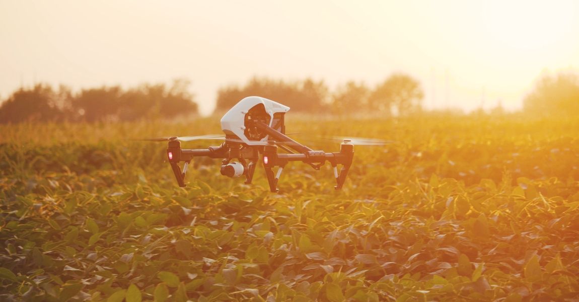
Above: Today’s drones give the term “low altitude” a whole new meaning. Flying centimeters from the ground is a cinch, even for common store-bought models.

Low-Altitude Perception

Aside from what to search for, where to search can also be a problem for radars not explicitly engineered for drone detection. We’ve all heard the phrase “flying under the radar,” derived from the stealth techniques of World War II fighter pilots. These days, using this method to elude detection in an airplane is improbable. For a drone, however, it’s a piece of cake.

Common quad-copters can easily fly an arm’s length above the ground, and some criminals rely on their propensity to do that. With clever programming, a drone can traverse long distances at low altitude, avoid obstacles as it goes, and slip into restricted zones completely unnoticed. Regular ground-to-air radar stands no chance of picking this up, but the leading drone radar systems can see drones regardless of altitude.

Fortem TrueView® radars are especially good at this. Each unit is GPS-enabled and pre-loaded with topographical knowledge of almost the entire planet. High-resolution elevation maps enable the radar to know where it’s positioned in relation to the ground below it, as well as where the ground is at any given distance. Each radar also has inertial sensors that measure its orientation with sub-degree accuracy. By possessing an intimate knowledge of its own surroundings, a TrueView® drone radar can track objects moving near the ground with precision.

Consumer drone flying slowly 
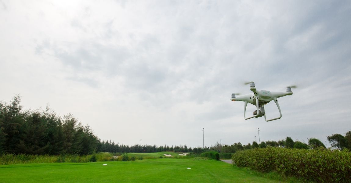
Above: No matter their altitude, consumer quad-copters can stay hidden from conventional radar emplacements by traveling very slowly.

Tracking at Slow Speeds

Approaching at a snail’s pace is another way drones can subvert traditional radar. Coarse doppler resolution is the norm for many radars because it’s well suited to their purpose. To illustrate what this means, we can use the ATC radar we talked about earlier. ATC radar is used to track inbound, outbound, and passing aircraft. All of these aircraft move with considerable speed, even during takeoff and landing. If they’re not moving fast, then they’ve already landed, in which case there’s no need to track them.

The slowest sustained speed expected by air traffic controllers is just below 20 knots — a prevalent standard for helicopters in air taxi. Radars with coarse doppler resolution are A-OK for tracking vehicles at this speed. But drones can travel much slower. Hovering right above the ground, a typical quad-copter drone can fly forward at a creeping 0.5 m/s (1.1 mph). To register objects moving this gradually, you need fine doppler resolution.

All drone radar systems have very fine doppler resolution, as it’s considered essential for counter-UAS. By the way, TrueView® drone radars are in a league of their own when it comes to slow-speed tracking. While competing drone radars can track objects at 0.5m/s (1.1 mph), TrueView® radars can follow fractions of that figure. Just stating for the record.

Hand blocking sun to help visualize null steering Above: Null steering is one of several technologies drone radars use to overcome clutter. You can visualize how it works by using your hand to block the sun.

Performance Despite High Clutter

Airport radars have been useful for comparison so far, but let’s put them aside now. Because airports aren’t the only establishments threatened by drones. Metropolitan areas are just as likely to experience drone-related incidents, especially at stadiums, event centers, and places of gathering. Zones with tall buildings, raised highways, and busy intersections aren’t necessarily hard for a drone to navigate. But they’re impossible for an average radar to comprehend.

Drone radars excel at spotting drones in spite of environmental clutter. How a drone radar deals with clutter depends on the manufacturer, but we’ll look at models from our TrueView® family of drone detectors for reference. In addition to their high channel count (16 independent channels in the R30’s case), TrueView® radars use STAP and related technologies to perform in cluttered zones with very few compromises.

STAP, or Space-time Adaptive Processing, is an advanced set of algorithms for radar signal processing. One key aspect of STAP is null steering, which lets the radar suppress high-intensity signals in order to better see the signals around them. To visualize this, imagine staring at a cloud right beside the sun. It’s hard to make out the cloud’s details at first, until you extend your hand to block the sun’s rays. Now, you can focus on the cloud much more easily. Since our radar is never overwhelmed by one signal’s interference, it can remain vigilant of all the others.

Multi-path mitigation algorithms also factor into our drone radar’s city suitability. Signals can bounce around a lot in urban environments. Without a way to account for this, a generic radar is ignorant of where each signal actually comes from. This isn’t the case for a TrueView® drone radar, which can account for what we call “multiple paths.” If a signal originates from a drone 50 meters above ground level, yet it bounces off the ground before our radar receives it, our radar is conscious of the diversion and can estimate where the drone truly is.

Only specialized radars need to do these things. So, naturally, most others can’t.

Closing

In summary, radar is a marvelous way to detect and track intruding drones, but only if your radar is specifically designed for it. Attempting to use a different type of radar is like bringing a golf club to the batter’s box. To a certain extent, it’s very similar to a baseball bat. Both are clubs intended to whack something round. That’s where the similarities end, though. You’d never try to hit a hole in one with a bat, let alone knock one out of the park with a 5-iron. Fundamentally, they’re the same. But, functionally, they couldn’t be more different.

Defending Against Group-3 Drones


fortemtech.com

White Paper: Defending Against Group-3 Drones


 Victoria Nelson Oct 31, 2022 7 mins

Executive Summary

The use of unmanned aerial systems (UAS), or “drones,” has been essential to military operations since the 1970s; drones closely fitting the modern definition have existed since the 1950s. Drones aren’t newcomers on the battlefield, but technology continues to get more sophisticated and, in turn, more difficult to stop.

The battlefield of tomorrow requires a new outlook on C-UAS. Defending the skies against more significant drone threats like the Orlan-10 and Shahed-136 is necessary for military forces. How can the DoD defeat these drones while reducing costly collateral damage and protecting innocent civilians?

This whitepaper will summarize the current challenges in combating weaponized UAS/UAVs, specifically the significant threats posed by ever-evolving Group-2 (21 to 55 pound) and Group-3 (55+ pound) drones. We will examine what solutions are currently available to defend against said threats. Finally, we will discuss the Counter-UAS (C-UAS) solutions that Fortem Technologies offers to address the newest drone threats and the danger they pose to public safety.

Current Situation, Summarized

Since Russia’s full-scale invasion of Ukraine, drone attack reports have dominated headlines worldwide; on any given day, you can find video footage online of air strikes where UAVs carrying explosives decimate a target.

This week, The Washington Post reported that Iranian Shahed-136 drones were used in a recent attack on the Ukrainian capital, Kyiv, targeting power stations and other utilities. The use of these drones comes as no surprise. In July, White House National Security Adviser Jake Sullivan said that the administration had “information that the Iranian government is preparing to provide Russia with several hundred UAVs.” The Russians use these weapons to devastating effect without consideration of risk to their troops or the cities filled with innocent civilians.

The expansion of attack drones in military conflict and the proliferation of enemy/terrorist drone developments are only escalating the need for a viable C-UAS response. Large-scale hostilities reach far beyond the battlefield, with civilian casualties reported on all sides.

It is estimated that the global defense/military drone market will reach $23.78 billion by 2027 as drones have become a primary tool used in today’s world for combat, research, development, target decoys, or supervision purposes (source: Fortune Business Insights). With increased military spending on UAS, defending the skies against threats like the Orlan-10 and Shahed-136 is unavoidable. So how do we ensure mission-critical success while addressing the call to action our world leaders have pressed upon defense organizations to defend our skies and protect innocent bystanders?

Are All Methods of Defeat Created Equal?

The Iranian-made Shahed-136 “suicide” or “kamikaze” drone has a range of 1,500 miles, weighs 440 pounds, can carry an 80-pound explosive warhead in its nose, and travels at speeds up to 115 mph. These drones can be fired from a mobile, truck-mounted launcher, making it difficult to detect “left of launch.” Its small size, low altitude and speed, and ability to change direction in flight make it harder to detect and track using most radar solutions, but not impossible.

Let’s look at the varied defeat methods available in today’s market:

Jamming. Experts say the Shahed-136 depends on a small civilian motor and commercially available GPS systems, making it susceptible to jamming. The issue with using this takedown approach is the possibility of collateral damage and personal injury that a crashing drone can cause. Using a drone jammer risks interfering with the signals of other mission-critical devices nearby.

Missiles. While missiles are very good at killing drones, they are considered one of the most costly approaches to C-UAS. Missiles make sense when you’re dealing with a much larger aircraft, like the Shahed-136 drone, but this approach also creates an issue of collateral damage and loss of innocent lives. Blowing a drone out of the sky with a shoulder-fired warhead will inevitably bring flaming shrapnel down on something or someone.

Intercepting. We would argue that the most intelligent way to defeat more significant drone threats is with another drone — a drone interceptor, to be exact. Drone interceptors are highly-advanced UAVs that specialize in defeating other drones. This way, the threat is not only neutralized, but it also minimizes the issue of costly collateral damage and loss of life or injury.

Enter the DroneHunter® F700 platform.

The World’s Best Drone Interceptor

The DroneHunter® F700, part of the Fortem Technologies SkyDome® System System, is a “blue-force” interceptor built to detect, assess, and defeat low-flying UAVs. The fully autonomous, radar-guided F700 is a C-UAS with proven field success; purpose-built for speed and agility, it can stop opposing drones day and night, even in adverse weather conditions. Its ability to defeat more than one drone per mission and its quick relaunch time of under three minutes makes it an affordable and effective C-UAS solution.

Paired with our TrueView® R20 Radar, the F700 is one of the market’s most intelligent and spatially aware interceptors. Capable of acting alone or cooperating with multiple units to protect large, restricted areas, the F700 can take cues and updates from ground/fixed radar and even integrate with long-range government-supplied radars.

Armed with multiple NetGuns™ and revolutionary Drogue Chute, the DroneHunter® F700 can capture or disable rotary and fixed-wing crafts, including Group-1, Group-2, and Group-3 threats like the Russian Orlan-10 (reconnaissance) and Iranian Shahed-136 drones.

The onboard NetGun™ on the F700 fires a net, capturing an offending Group-1 or Group-2 drone and towing it to a specified location or dropping it to the ground (depending on size and speed). For the F700 to defeat or take down the faster, heavier Group-2 and Group-3 drones, a drogue chute attached to the F700 is used in conjunction with the net, destabilizing the threat and allowing for a slower descent and predictable landing.

In addition to the superior takedown methods employed by the DroneHunter® platform proudly touts the following features:

  • Easy Integration. While the DroneHunter® F700 can seamlessly integrate with the Fortem SkyDome® Manager software, a modern, open API allows the F700 to integrate with several of today’s leading command and control (C2), including FAAD C2.
  • Real-Time Data. The F700 will investigate offending drones while onboard optical cameras stream real-time data to the SkyDome® Manager C2, enabling informed risk assessment and long-range mitigation capability based on the most accurate data.
  • Autonomous Flight. Equipped with advanced AI for accurate threat assessment, the F700 evaluates threats, selects an appropriate operating mode, and autonomously adjusts tactics based on a threat’s level, location, speed, and direction.
  • 24/7 Readiness. Fixed SkyDome® System installations often employ several F700s spread out across a landscape, able to activate remotely, without human aid, at a moment’s notice. In this scenario, a weather-proof hangar called the DroneHangar™ houses the F700, keeping it in ready condition, charged, and protected from adverse weather conditions. Fortem Technologies offers a vehicle-mounted variant of the hanger for mobile needs.

In Conclusion

With nearly 5,000 drone captures, Fortem Technologies has perfected more than 68 scenarios to optimize against various threat profiles, sizes, and speeds. The systems started with slow targets, and with its newest round of platform enhancement, the F700 is performing against targets exceeding double those earlier documented speeds.

Fortem Technologies is currently working with a partner to provide the C-UAS solution for the Qatari Ministry of Interior and Safety and Security Operations Committee (SSOC) for the FIFA World Cup events starting in November of this year.

In May of this year, Fortem Technologies deployed two DroneHunter® F700s in Ukraine, where the Group-3 Shahed-136 drones are used to attack military bases, refineries, and other vulnerable sites. Recently, Fortem Technologies has been asked to deliver multiple units of the Fortem SkyDome® Man-Portable Counter-UAS systems to assist in the U.S. government’s long-term commitment to supporting Ukraine. Most defensive systems available are costly and take months or years to produce, limiting how many can be distributed and forcing military planners to prioritize sites deemed most vulnerable. The Fortem Technologies SkyDome® System System is the airspace awareness and C-UAS solution of choice.

Countering a Growing Aerial UAS Threat


fortemtech.com

Countering a Growing Aerial Threat


 Jon Gruen Dec 14, 2022 7 mins

Countering a Growing Aerial Threat
How Advanced AI and Radar Technology Power Precise Drone Detection and Capture

Introduction

In its 2022 National Defense Strategy, the U.S. Department of Defense highlights the growing threat from unmanned aerial systems (UAS), referring to them as “an inexpensive, accessible, flexible, expendable and plausibly deniable way to carry out armed attacks and project outsized power over a variety of domains.”

While threats from UAS increase in battle spaces and public spaces, the technology to counter them must adapt to contend with growing levels of sophistication. The same new technology trends that make drones more effective for use by state actors also make threat actors more dangerous. The DoD notes that UAS can now be similarly lethal to cruise missiles, can be launched and controlled autonomously or from great distances, and are able to travel “virtually undetected.”

As new threats develop, the optimal counter-UAS (C-UAS) program provides layered and customizable protection, from detection to capture, resulting in increased accuracy and minimizing or even eliminating collateral damage.

Anatomy of a Modern C-UAS

Top-of-the-line, modern C-UAS solutions leverage advanced radar technology to accurately detect threats, reduce false positives and autonomously capture the drone, resulting in a reusable, precise and cost-effective system capable of capturing a Russian Orlan-10 in combat or protecting spectators at the FIFA World Cup.

“Our DroneHunter F700 is cued from our ground-based radars, and then once it’s launched, it acts as its own seeker and tracker,” says Jon Gruen, chairman and CEO of Fortem Technologies. “We have a radar on the drone, and it has all the same processing and computability that the ground-based radars do, so it locks on and it goes after the drone based on the command it’s told.”

The cutting-edge radar capabilities on the DroneHunter itself result in a higher level of spatial-awareness and fewer false positives. Once the DroneHunter detects a potential threat, it determines via radar whether the drone is smaller or larger than itself and captures it using nets. If the drone is smaller, the DroneHunter tows it away. If larger, the DroneHunter releases a parachute to reduce velocity as it and the drone drop to the ground.

This flexibility enables the system to successfully take down a range of drone threats from Groups 1-3. Group 1 drones are the smallest, generally rotor-driven and store-bought. Group 2 drones are midsize, sometimes of fixed-wing design and may be used by militants and terrorist groups. Group 3 drones, such as the Orlan-10, Shahed-131 and 136, have been the most-talked about recently, with Shahed-136’s being deployed in Ukraine.

"When the Ukraine war broke out, they needed to be able to move and deploy a system with the ever-changing battle lines. So we took our system and made it man portable."

— JON GRUEN | CHAIRMAN AND CEO, FORTEM TECHNOLOGIES

To combat devastation from the Group 3 drones, Fortem designed a smaller, portable version of its C-UAS system, which is in service in Ukraine.

“When the Ukraine war broke out, they needed to be able to move and deploy a system with the ever-changing battle lines,” Gruen says. “So we took our system and made it man portable — we put a radar on a tripod, added a compact command and control tablet, and then the DroneHunter actually went into a backpack and had the ability to recharge and reset right there on the ground, from a backpack portable solution.”

Benefits of a Capture vs. Destroy Method

Traditional C-UAS programs end with the destruction of the drone, and often parts of the C-UAS itself. While this method eliminates the threat, it has significant downsides. A C-UAS that is able to capture rather than destroy contributes to mission success in three key ways:

  1. It minimizes collateral damage. Removing the threat instead of destroying it also removes the threat of debris hitting nearby people and infrastructure. For example, at the FIFA World Cup this technology is being deployed to protect stadium goers.
  2. It’s reusable. “We’re really the only drone in the world that can go chase and capture another drone, so that offers a lot of flexibility,” Gruen says. “Our drone is not a Kamikaze — or one-shot, one-kill — kind of system. We go up, we capture drones, we come back, we reset the net, and it’s back up attacking again.”
  3. It’s cost-effective. C-UAS that can defeat more than one drone per mission and have a short relaunch time are more efficient and affordable compared to traditional anti-aircraft measures. Deploying a missile to destroy a single drone is astronomically expensive. Even methods that rely on jamming or electromagnetic pulse can be costly in terms of the advanced equipment and amount of power required.

Given these three key benefits, the use cases for establishing C-UAS programs are extensive. C-UAS could be put in service to protect military, law enforcement, airports, stadiums and more. Even small events or gatherings are vulnerable to drone threats as smaller Group 1 drones become more affordable and commonplace.

"Our drone is not a Kamikaze — or one-shot, one-kill — kind of system. We go up, we capture drones, we come back, we reset the net, and it’s back up attacking again."

— JON GRUEN | CHAIRMAN AND CEO, FORTEM TECHNOLOGIES

Since 2015, the Federal Aviation Administration (FAA) has maintained an online registration system for small/recreational drones. FAA data demonstrates the growth in recreational drone ownership since the launch of this registration system. In its FAA Aerospace Forecast Fiscal Years 2022–2042, the FAA predicts the recreational small drone market may reach 1.84 million units by 2026.

As recreational use of drones increases, Gruen expects to see more commercial use as well. “You might start seeing some level of drone delivery or commerce through drones,” he says. “It’s all going to require new governance capabilities and structures out of cities and municipalities.”

The Future of the C-UAS Landscape

The DoD also predicts “UAS usage will likely expand and continue to pose a threat to U.S. personnel overseas, allies and partners, and potentially to the U.S. homeland.” Fortem is working to stay ahead of this evolving civilian and military threatscape by investing in tools that help our armed forces and local law enforcement effectively deter threats at scale.

“One of our major development efforts is to make sure we can counter a swarm with basically our own swarm, or a number of our systems having multiple effects, capture or kill capabilities at one time,” Gruen says. “So we’d be able to go and neutralize an incoming swarm effectively, and then relaunch to catch the next wave.”

C-UAS programs must also account for automation. Prior to advancements in drone technology, threat actors relied heavily on ground station signals to direct and fly the drone. Modern drones can be automated so that a human operator or pilot is no longer necessary to complete a flight plan, making some C-UAS methods, such as jamming, increasingly obsolete.

“When more modern threats sense they’re being jammed, they completely shut off their antennas and they fly the last flight plan to continue the mission,” Gruen says. “Previous countermeasures were mostly radio-frequency-based, trying to hack the platform itself or jam the signal. That’s really becoming irrelevant today — you have to take it out physically.”

In this ever-changing environment, collaboration is key. The development of effective countermeasures depends on a well-rounded understanding of the drone threatscape at present, which is why Fortem values its collaboration with commercial and government organizations.

“We’re fortunate in that we have great partnerships, both in the U.S. government, as well as a vast number of international and commercial customers,” Gruen says. “We’re able to talk to them, see the threats that they think are coming and plan our development efforts accordingly.”

New Fusion Record Achieved in Tungsten-Encased Reactor

New Fusion Record Achieved in Tungsten-Encased Reactor Isaac Schultz Summary The WEST (Tungsten Environm...