 |
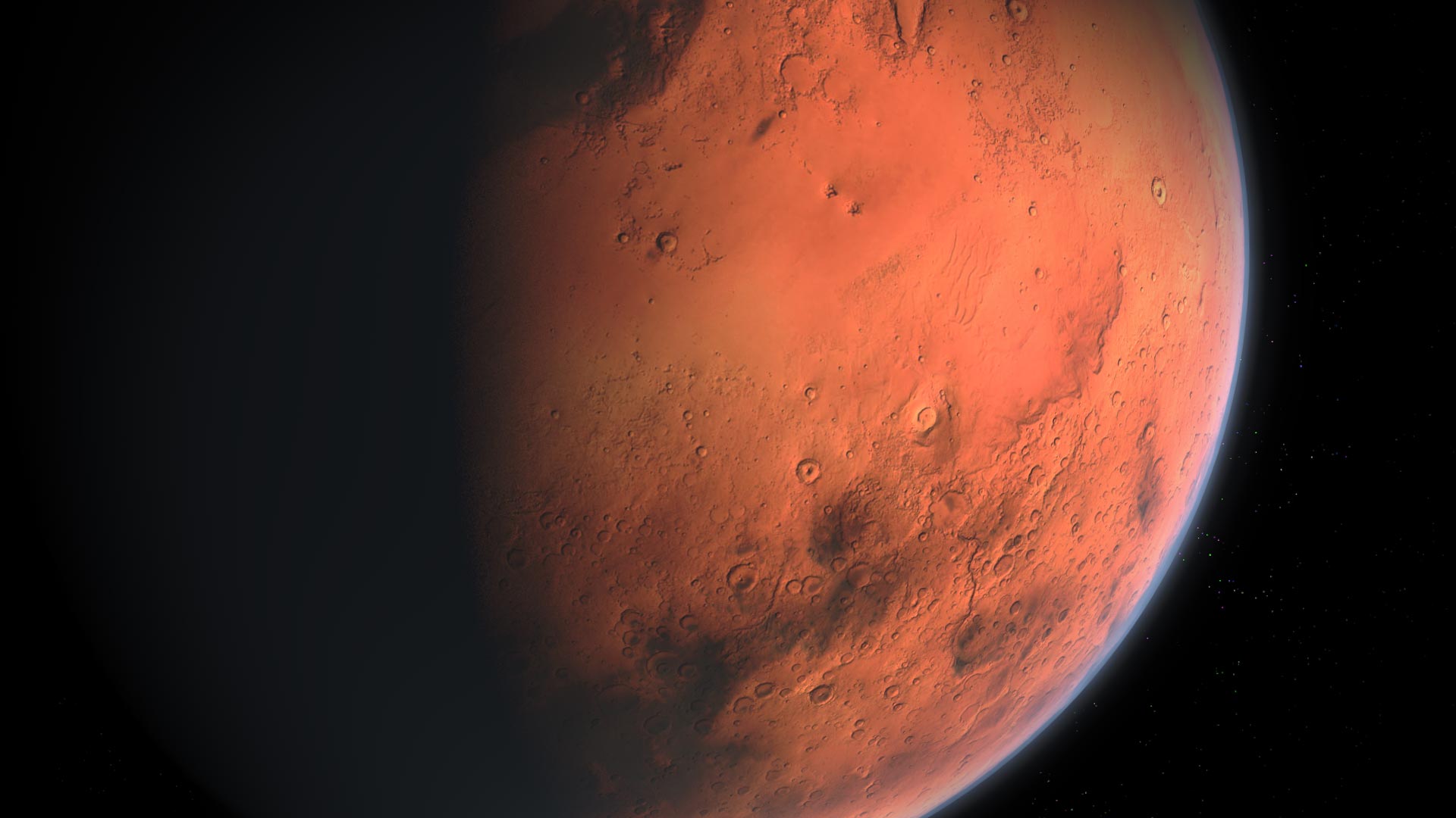
| South Pole of Mars |
Summary
1. Cornell University researchers have proposed a simpler explanation for bright radar reflections observed beneath Mars' south pole, challenging previous assumptions about subsurface lakes.
2. Their simulations show that small variations in layers of water ice, too subtle for ground-penetrating radar to resolve, can cause constructive interference between radar waves, producing reflections that match observations.
3. This explanation does not require the presence of liquid water, exotic materials, or extreme environmental conditions.
4. The interference hypothesis is consistent with the sparse, widespread pattern of bright reflections observed across the south polar layered deposits (SPLD) base.
5. While the exact layering scenarios at the base of the SPLD cannot be determined, similar layering has been observed in the north polar layered deposits (NPLD).
6. The study concludes that constructive interference is a plausible explanation for the bright radar reflections, compatible with available observations and known Martian conditions.
7. This research challenges the exciting possibility of liquid water beneath Mars' south pole, suggesting a more mundane but scientifically sound explanation.
8. The article also mentions an earlier 2018 study that had initially interpreted these radar reflections as evidence of liquid water, which had significant implications for potential microbial life on Mars.
9. The new explanation is more consistent with current understanding of Mars' environmental conditions, including temperature and pressure, which make liquid water unlikely at the observed depths.
Cornell researchers explain Mars’ bright radar reflections with ice layer interference, challenging the idea of liquid water beneath the pole.
Cornell University researchers have provided a simple and comprehensive – if less dramatic – explanation for the bright radar reflections initially thought to be liquid water under the ice cap at Mars’ south pole.
Their simulations show that small variations in layers of water ice – too subtle for ground-penetrating radar instruments to resolve – can cause constructive interference between radar waves. Such interference can produce reflections whose intensity and variability match observations to date – not only in the area proposed to be liquid water, but across the so-called south polar layered deposits.
“I can’t say it’s impossible that there’s liquid water down there, but we’re showing that there are much simpler ways to get the same observation without having to stretch that far, using mechanisms and materials that we already know exist there,” said Daniel Lalich, research associate in the Cornell Center for Astrophysics and Planetary Science. “Just through random chance, you can create the same observed signal in the radar.”
Lalich is the first author of a recent study published in Science Advances.
Robotic explorers have provided extensive evidence that water flowed on the surface of ancient Mars, including at a former river delta now under investigation by NASA’s Perseverance rover. Relying on a radar instrument that can probe below the surface to detect water ice and potentially hidden aquifers, members of the European Space Agency-led Mars Express orbiter’s science team in 2018 announced they’d discovered a lake buried below the south polar cap.
The implications were enormous: Where there is liquid water, there could be microbial life.
Reinterpreting Radar Observations
But while the same bright radar reflections would likely indicate a subglacial lake on Earth, Lalich said, the temperature and pressure conditions on Mars are very different.
Using simpler models, Lalich previously showed that the bright radar signals could be created in the absence of liquid water, but he said assumptions about layers of frozen carbon dioxide below the ice cap likely were incorrect.
The new research tells a more complete story, he said, closing gaps in the radar interference hypothesis with more realistic modeling. The thousands of randomly generated layering scenarios were based only on conditions known to exist at the Martian poles, and varied the ice layers’ composition and spacing in ways that would be expected over tens or hundreds of miles.
Those slight adjustments sometimes produced bright subsurface signals consistent with observations in each of the three frequencies used by the Mars Express orbiter’s MARSIS radar instrument, a partnership between NASA and the Italian Space Agency. Likely for a simple reason, Lalich argues: Radar waves bouncing off layers spaced too closely for the instrument to resolve may be combined, amplifying their peaks and troughs.
“This is the first time we have a hypothesis that explains the entire population of observations below the ice cap, without having to introduce anything unique or odd,” Lalich said. “This result where we get bright reflections scattered all over the place is exactly what you would expect from thin-layer interference in the radar.”
Conclusion: The Likelihood of Liquid Water
While not ruling out the potential for some future detection by more capable instruments, Lalich said he suspects the story of liquid water and potential life on the red planet ended long ago.
“The idea that there would be liquid water even somewhat near the surface would have been really exciting,” Lalich said. “I just don’t think it’s there.”
Reference: “Small variations in ice composition and layer thickness
explain bright reflections below martian polar cap without liquid water”
by Daniel E. Lalich, Alexander G. Hayes and Valerio Poggiali, 7 June
2024, Science Advances.
DOI: 10.1126/sciadv.adj9546
The research was supported by NASA.
Small variations in ice composition and layer thickness explain bright reflections below martian polar cap without liquid water
Abstract
Abnormally bright radar reflections below the Martian south polar layered deposit were originally interpreted as evidence of subglacial liquid water. However, unlike on Earth, conditions beneath the Martian ice are too cold to create or maintain meltwater. In this work, we use radar reflectivity simulations to show that the strong reflections can instead be caused by constructive interference between dusty ice layers that are more closely spaced than the radar resolution. Unlike previous hypotheses, interference does not require anomalous subsurface conditions or exotic materials to be present beneath the ice. In addition, interference between thin layers can explain the variable power of radar returns beneath the entire ice sheet and does not require different mechanisms to be responsible for reflections in different regions.
SIGN UP FOR THE SCIENCEADVISER NEWSLETTER
The latest news, commentary, and research, free to your inbox daily
INTRODUCTION
Recent radar observations from below the Martian south polar layered deposit (SPLD) have reignited debate about the potential presence of liquid water on modern day Mars (1–5). The SPLD is a formation of nearly pure water ice that can reach more than 3 km thick and is approximately centered over the South Pole (6). Within the SPLD, many ice layers with variable amounts of dust impurities are visible in both optical and radar data (6), although layers in the two datasets have yet to be positively correlated with each other (7). Because of the dome-like structure of the SPLD, the contact between its base and the underlying bedrock is not visible in imagery, but it can be detected by radar (8, 9). Recently, observations by the Mars Advanced Radar for Subsurface and Ionosphere Sounding (MARSIS) on board the Mars Express orbiter have revealed the presence of anomalously bright basal reflections scattered beneath the entire SPLD (10). On Earth, similar radar signatures below ice sheets are often indicative of subglacial lakes or other hydrological features (11, 12), which led to the initial interpretation that the bright MARSIS reflectors were evidence of liquid water (2).
Here, we present evidence for an alternate interpretation. When multiple material interfaces are present at subresolution scales, reflections from each interface can constructively interfere with one another, creating bright reflections. The resulting radar signature becomes a function not only of composition but also of layer thickness (13). Recently, simulations showed that relatively thin layers of CO2 ice near the base of the SPLD could constructively interfere, resulting in reflections of a similar magnitude to those observed by MARSIS (3). There are doubts, however, surrounding the plausibility of solid CO2 buried so deep below the water ice (14), and while the stratigraphies simulated in past work produced bright reflections, there was no single layering scenario that was consistent with observations at each MARSIS frequency.
In this work, we close these gaps in the interference hypothesis by modeling realistic MARSIS reflections caused by simple layering scenarios. By modeling the radar return from thousands of semirandom stratigraphies, we show that it is possible for a single set of layers to produce reflections that match the MARSIS observations at each frequency simply by varying the amount of dust or other impurities within each icy layer. Furthermore, we do so without introducing any additional material constituents beyond water ice and dust. We also demonstrate that small changes in layer thickness and dust content may explain the wide distribution of observed reflection powers both within and outside of bright reflectivity regions more easily than other proposed mechanisms.
While multiple hypotheses have been put forward to explain the bright SPLD basal reflections, none have been consistent with all available observations (3–5, 10, 15, 16). Thermal modeling using a realistic range of geothermal heat fluxes indicates that the temperature at the base of the SPLD is not warm enough to melt the overlying ice and create liquid water, even under favorable conditions (15, 16). Brines were suggested as one way to lower the melting point, but even with heavily saturated brines, the melting point remains above the best-case basal temperature (17), and the volume of salts that would need to be concentrated in one area to produce those brines is difficult to reconcile (16). While the initial finding was limited to one small location beneath the SPLD (2), subsequent and more comprehensive radar mapping of the SPLD basal contact has shown that similar bright reflections are somewhat common in both MARSIS (10) and Shallow Radar (SHARAD) data (18) across the entire formation, including in places where the ice thickness is much less than 1 km and thus not amenable to the presence of melt. Such a widespread geographical distribution of strong reflections casts doubt on the hypothesis that extreme but highly localized conditions (such as a recent magma chamber) could be a possible explanation for meltwater at the original discovery site (15). A recent analysis of all MARSIS reflections across the entire surface of the planet also found that approximately 2% of the dry Martian surface produced reflections as bright as those initially identified as liquid water, even after correcting for additional attenuation through dusty ice (19). While the cause of those bright surface reflections remains unclear, their presence does indicate that there must be conditions on Mars capable of producing strong reflections in the absence of liquid water.
In addition to liquid water, the presence of other high-reflectivity materials has been invoked to explain the bright reflections. The most commonly investigated scenarios involve the presence of hydrous clay minerals or saline ice (4, 5). However, saline ice faces similar questions to liquid brines regarding the source, concentration, and emplacement mechanism of the salts, and while initial laboratory experiments with conductive clay minerals were promising (4), further testing at more relevant temperatures has cast doubt on that hypothesis as well (20).
To investigate the constructive interference hypothesis in more detail, we started with a thin layer reflectivity model previously used for radar sounder analysis on Mars (3). The model is capable of calculating the effective reflectivity of a group of subresolution layers with arbitrary thickness and composition. For this work, we generated 10,000 semirandom SPLD basal layering scenarios as input for the model. Each set of layers was limited to 100 m in total thickness (approximate MARSIS vertical resolution). Layers consisted of either pure ice or a mixture of ice and dust. The number of dusty layers along with their thickness, separation, and dust content was randomly generated using constraints from previous studies when possible (Fig. 1 and see Materials and Methods) (7, 13, 21). Specifically, layer thickness was allowed to vary between 1 and 20 m, average separation distance was set to 10 m, and dust content varied between 20 and 100%

Fig. 1. Examples of semirandom basal layering scenarios used as input for reflectivity modeling.
Each scenario shown produced reflections consistent with those in the originally defined bright region (2). Permittivity, shown on the x axis, is positively correlated to dust content.
Once the original set of basal layering scenarios was created, we modeled the effective reflectivity of each scenario, assuming that the layers were situated beneath water ice with a bulk composition consistent with that of the SPLD and above solid, dry bedrock. Following a previously established method (19), we then used the modeled reflectivity to estimate the corresponding normalized basal echo power for the same set of layers beneath approximately 1400 m of SPLD ice, consistent with the original detection of strong reflections (2). We used standard assumptions for SPLD attenuation and surface reflectivity (see Materials and Methods). Converting the effective reflectivity into inferred basal echo power allowed us to compare our model results directly to observations. Last, we repeated the above procedure 1000 times for each original layering scenario, applying meter-scale variations to layer thickness and small changes to dust content (typically less than 10%) for each iteration (Fig. 2 and see Materials and Methods). The result was a separate distribution of normalized basal echo powers for each starting scenario, where each value in the distribution corresponds to a variation on the original set of layers. This step allowed us to investigate the distribution of basal echo powers that would arise from small changes in layer thickness or composition that naturally occur laterally over tens of kilometers, the approximate scale of the initially identified bright region (2). Normalized basal echo power was calculated for each of the three MARSIS frequencies for every modeled scenario.

Fig. 2. Single layering scenario used to generate distributions both inside and outside the bright region.
(Left) Originally generated layering scenario, consistent with reflections in bright area. (Right) Variation on original scenario, consistent with reflections outside bright area.
To determine whether the same stratigraphy could explain MARSIS returns both within the bright region and in the surrounding area, we carried out one final group of simulations. From our initial results, we selected the distributions with basal echo powers consistent with observations inside the bright area, which we defined as median basal power higher than surface power at each frequency, and descending median basal power from 3 to 5 MHz. From each of the distributions matching that criteria, we selected the individual layering scenario variant whose corresponding basal echo power most closely matched the median return outside of the bright area, rather than inside of it (i.e., it was consistent with “normal” dimmer reflections). We then introduced small variations in layer thickness and dust content to that set of layers, following the same process described in the previous paragraph (see Materials and Methods), creating new basal echo power distributions. The end result is two paired normalized basal echo power distributions: one corresponding to MARSIS reflections inside the bright area and the other corresponding to MARSIS reflections outside the bright area using the same basic layer structure (e.g., Figs. 2 and 3). In this way, we simulate a change in the average layer thickness and composition of the same set of layers over a large lateral area (i.e., inside and outside of the bright area) while still including smaller-scale local variability.

Fig. 3. Simulated and observed basal echo power distributions.
(Top row) Distribution of simulated MARSIS normalized basal echo power for a single starting scenario capturing the behavior both inside the bright area (gray histograms) and outside the bright area (red histograms). (Bottom row) Observed normalized basal echo power distributions both inside the initially defined bright area (2) (gray histograms) and the surrounding region (red histograms). Dotted lines indicate the median value of the observed power distributions.
RESULTS AND DISCUSSION
Of the original 10,000 semirandomly generated layering scenarios, 216 produced distributions with median normalized basal echo powers that were consistent with bright MARSIS observations in terms of both reflection strength and the power ratio between frequencies, i.e., the 3-MHz reflection power was the strongest, followed by 4 MHz and then 5 MHz (17). In 99 of those layering scenarios, the echo strength and frequency ratio of the paired distributions were also consistent with observations outside of the bright region (Fig. 3). Inspection of the qualifying layering scenarios does not reveal any obvious patterns or common features besides the inclusion of at least one layer with a permittivity approaching that of pure lithic material (Fig. 1).
The basal echo power distributions produced by applying small changes in layer thickness and composition are qualitatively similar in shape to the observed data (2) but are slightly narrower and feature a tail toward low values (Fig. 3). The interquartile range (IQR) of observed normalized basal echo powers in the bright region is approximately 4.7, 6.2, and 5.6 dB at 3, 4, and 5 MHz, respectively. Outside of the bright region, the observed IQRs for each frequency are 4.9, 4.6, and 4.4 dB. Typical IQRs for our modeled stratigraphies are between 2 and 4 dB in both cases.
The results described above demonstrate that interference between subresolution layers can produce radar reflections consistent with MARSIS observations below the SPLD, including their frequency-dependent behavior and their regional variability. Furthermore, these results were obtained without exotic materials and without invoking extreme environmental conditions. While a relatively small number of our layering scenarios produced bright reflections consistently across frequencies, this is to be expected, as in reality most SPLD basal reflections are not bright (10), and constructive interference requires precise layering. However, the exact fraction of simulated scenarios that produced constructive interference is not particularly meaningful. The layering scenarios were only semirandom, and the initial constraints used in their generation could influence the final results, such that the fraction of consistent scenarios might vary. In addition, real layers are typically deposited by nonrandom processes, which will result in different patterns of variability compared to our randomly generated stratigraphies.
Our results are also consistent with the observation that bright reflections are sparsely distributed across the entire base of the SPLD, with no correlation to subsurface conditions or overlying ice volume (10). In the case that bright reflections are due to liquid water, one might expect a correlation with total SPLD thickness, as thick ice cover is believed to be necessary to create melt conditions (15–17). However, previous work has shown that no such correlation exists, and instead bright reflections are found even near the thin SPLD margins (10, 18). While anomalously high geothermal heating may be able to explain the presence of meltwater in an isolated location (15), it is inconsistent with the widespread nature of observed strong reflections. Similarly, if bright reflections are caused by exotic minerals or other compositional changes, then there must be some explanation for why they are sparse in density, geographically extensive, and do not seem to correlate with surface or bed topography. Interference, on the other hand, is essentially independent of other environmental conditions such as total ice thickness, heat flux, or basal topography. Given the precise layering required to generate constructive interference and the changes in layer thickness expected over kilometer scales, the quasi-random, sparse, widespread pattern of bright reflections is exactly what one would expect. Similar resonant behavior has already been identified in the north polar layered deposits (NPLD) using multiband SHARAD data, with interference patterns changing over distances as small as 1 km, which is less than the MARSIS spatial resolution (22, 23).
Notably, interference also presents the most plausible explanation for the wide range of observed basal echo powers. Previous inversion analysis found that basal permittivity would have to vary by more than two orders of magnitude over kilometer-scale distances to match observations of SPLD basal echo power (2, 24). The brightest reflections would require relative permittivities in excess of 300 (24), which is more than three times greater than pure liquid water. These large changes in composition over relatively small distances are difficult to explain using geologic materials and are not common elsewhere on Mars. In contrast, while our modeling also struggles to match the extremes of the observed power distributions, changes of a few meters in layer thickness and less than 10% dust content over the same kilometer-scale distances produce variability close to that observed by MARSIS (Fig. 3). These small changes in layer thickness could reasonably arise from changes in paleo-accumulation rates and are consistent with measurements of layer thickness variability made at SPLD outcrops (7). No estimates of dust content for individual layers in the SPLD exist, but changes of a similar magnitude are observed in the NPLD (13).
While modeled variability due to changing layer thickness tends to be smaller than observations, our analysis does not include changes to secondary parameters that affect observed reflectivity, such as interface roughness, attenuation, and the bulk dust content of overlying ice, all of which are likely to vary from region to region. Our model also assumes sharp, instantaneous contacts between layers, while contacts between real layers can become sharper or more gradational over large distances. Our chosen value for dust and rock permittivity also remains unchanged between model runs, while in reality it is possible for that value to vary between locations based on the precise composition of the lithic material. Perhaps most importantly, while we were unable to determine the radiometric precision of MARSIS, target precision for SHARAD, a similar Mars radar sounder, was ~2 dB (25), which is comparable to the difference between our modeled variability and the observed variability. We expect that contributions from each of these factors would broaden the modeled distributions shown in Fig. 3, but without better constraints, it is difficult to say by how much.
It is important to be clear that our analysis cannot determine which specific layering scenarios exist at the base of the SPLD. One of the primary results of this work is that the conditions that lead to bright reflections are nonunique and relatively easy to generate, even when accounting for the available constraints on layer thickness and composition. It is likely that none of the randomly generated layering scenarios used in this work represent the true stratigraphy at the base of the SPLD. However, observations of the NPLD and its underlying basal deposit show that layering similar to that generated here is certainly plausible (26). While pure dust or lithic layers are not observed in the upper NPLD, large sand and dust sheets tens of meters thick can be observed in both radar and visible imagery near the base and within the underlying cavi unit (26). It is believed that these sand sheets are paleo-dune fields preserved by later ice deposition (26), and it is plausible that similar features could exist near the base of the SPLD.
While we lack the ability to make specific predictions about basal layering, we can confidently state that the constructive interference hypothesis is compatible with the available observations. The process is consistent with the magnitude and distribution of observed echo powers across frequencies, as well as the geographic distribution of bright echoes. It requires no rare materials to be present and is agnostic of environmental conditions such as geothermal heating. Interference is also known to affect radar reflection power elsewhere on Mars (22, 23). While the diversity of layering scenarios that produce constructive interference is too large to place constraints on the actual basal stratigraphy, we do know that broadly similar layering exists at the base of the NPLD (26) and is thus plausible for the SPLD as well. In contrast, other hypotheses often require anomalous environmental conditions or the presence of uncommon materials and are inconsistent with either the geographic distribution or frequency-dependent behavior of the bright reflections.
MATERIALS AND METHODS
Each individual layering scenario is randomly generated based on five inputs: total stratigraphic thickness, mean separation between dusty layers, maximum dusty layer thickness, and minimum and maximum dust content for dusty layers. For this work, the total stratigraphic thickness was set to 100 m, mean separation was 10 m, maximum layer thickness was 20 m, and dust contents were between 20 and 100%. These values were chosen on the basis of the nominal MARSIS vertical resolution, measurements from SPLD outcrops (7), and the inferred composition of similar NPLD layers (13, 21). Layering scenarios are expressed as two vectors, one containing dielectric permittivity (i.e., composition) and the other containing layer thickness. Scenarios are initially generated meter by meter. For every meter, a random number is drawn and compared to the period defined by the inverse of the mean separation distance. If the random number is less than the mean period, then a new dusty layer is inserted into the stratigraphy. The thickness of the dusty layer is randomly determined from a uniform distribution between 1 m and the maximum possible thickness (20 m). The dust content of the layer is chosen randomly from a uniform distribution with the previously defined minimum and maximum values. That dust content is then inserted into the Maxwell-Garnett mixing formula to calculate the layer’s permittivity, assuming a mixture of pure ice and basaltic dust. Dust permittivity was assumed to be 8.8 – i × 0.17, which differs slightly from the typical Shergottite value used in previous work (3, 13). Our value was chosen such that a mixture of pure ice and 10% dust matches the measured bulk loss tangent of the SPLD (17). Once the cumulative sum of all layer thicknesses exceeds 100 m, the column is normalized such that the total thickness is exactly 100 m. All sections of the stratigraphy other than the defined dusty layers are assigned a permittivity consistent with pure water ice at MARSIS frequencies (27).
To apply small changes to each layering scenario (and thus simulate variability over regional scales), we first determine new layer thicknesses. The new thickness for each layer is drawn randomly from a normal distribution with mean equal to the layer’s original thickness and an SD equal to one-third of that thickness. After new thicknesses are drawn for each layer, the entire set of layers is once again normalized to be 100 m thick in total. Rather than determining a new dust content for each dusty layer, the permittivity is altered directly. For each dusty layer, a value is drawn from a normal distribution with a mean of zero and an SD of 0.25, and that value is then added to or subtracted from the original permittivity. For context, a difference of 0.25 in relative permittivity corresponds to approximately an 8% change in dust content using the Maxwell-Garnett mixing formula.
To model the total effective reflectivity of our randomly generated stratigraphies, we use a standard procedure commonly used to model Martian radar sounder data in the past (3, 4, 13). We will briefly describe the method here. For a full derivation and in-depth analysis of the method, see (28, 29), although note that we use our own implementation of the model, which we have made publicly available. First, a 2 × 2 constitutive matrix (M) is constructed for each intermediate model layer
Here, γ is the propagation constant inside the layer, d is the thickness of the layer, and η is the admittance of the layer. The propagation constant and admittance are each related to the permittivity of the layer and the frequency of the radar. The matrices for each intermediate layer are then multiplied together, producing a final characteristic matrix representing the full set of layers (Mtot)
The elements of the characteristic matrix are related to the total effective reflectivity by the formula
where ηf and ηL are the admittance of the first model layer (free space) and the last model layer (bedrock).
Because MARSIS transmits with a 1-MHz bandwidth around each center frequency, this process must be repeated for all sampled frequencies within each separate bandwidth. For our modeling, we chose to sample every 1 kHz. The results are then combined into the final effective reflectivity for each operating mode by integrating over the frequency bandwidth, following the method of Lalich et al. (13).
To directly compare our model results to observations, we convert modeled reflectivity into inferred normalized basal echo power. According to Grima et al. (19), normalized basal echo power can be expressed as
where Pss/Ps is the normalized basal echo power, Rss is the subsurface reflectivity, Rs is the surface reflectivity, Ts is the transmission coefficient through the surface (equal to 1 − Rs), and A is the two-way attenuation through the overlying ice. The attenuation A can be expressed as
where f is the radar frequency, τ is the one − way propagation time, and tanδ is the loss tangent through the overlying ice. The surface reflection and transmission coefficients were calculated using the standard Fresnel equations, assuming a surface permittivity consistent with previous measurements of bulk SPLD ice (17). The attenuation was calculated separately for each center frequency, assuming a one-way propagation time of 17 μs (approximately 1400 m in water ice), consistent with measurements in the originally identified bright region (2), and a bulk loss tangent consistent with the most recent measurements in the area (17). The influence of intermediate reflectors was not explicitly considered in our model; however, the derivation of loss tangent in (17) implicitly includes their influence. By inserting our modeled subsurface reflectivity (Rss) into the above equations, we can produce an inferred normalized basal echo power (Pss/Ps).
Acknowledgments
We would like to thank the MARSIS and SHARAD science teams as well as the Italian Space Agency (ASI), who developed both radar instruments. We would also like to thank the anonymous reviewers for their comments.
Funding: This work was supported by NASA grants 80NSSC21K1094 and NNX16AR90G.
Author contributions: Conceptualization: D.E.L., A.G.H., and V.P. Methodology: D.E.L., A.G.H., and V.P. Writing—original draft: D.E.L. Writing—review and editing: D.E.L.and A.G.H.
Competing interests: The authors declare that they have no competing interests.
Data and materials availability: All data needed to evaluate the conclusions in the paper are present in the paper and/or the Supplementary Materials. Relevant MATLAB codes used to generate the results described in this paper are available via the following online archive, as are all generated stratigraphies and model results: https://zenodo.org/records/10993721.
REFERENCES AND NOTES
1
D. M. Schroeder, G. Steinbrügge, Alternatives to liquid water beneath the south polar ice cap of mars. Geophys. Res. Lett. 48, e2021GL095912 (2021).
2
R. Orosei, S. E. Lauro, E. Pettinelli, A. Cicchetti, M. Coradini, B. Cosciotti, F. D. Paolo, E. Flamini, E. Mattei, M. Pajola, F. Soldovieri, M. Cartacci, F. Cassenti, A. Frigeri, S. Giuppi, R. Martufi, A. Masdea, G. Mitri, C. Nenna, R. Noschese, M. Restano, R. Seu, Radar evidence of subglacial liquid water on Mars. Science 361, 490–493 (2018).
3
D. E. Lalich, A. G. Hayes, V. Poggiali, Explaining bright radar reflections below the south pole of mars without liquid water. Nat. Astron. 6, 1142–1146 (2022).
4
I. B. Smith, D. E. Lalich, C. Rezza, B. H. N. Horgan, J. L. Whitten, S. Nerozzi, J. W. Holt, A solid interpretation of bright radar reflectors under the mars south polar ice. Geophys. Res. Lett. 48, e2021GL093618 (2021).
5
C. J. Bierson, S. Tulaczyk, S. W. Courville, N. E. Putzig, Strong MARSIS radar reflections from the base of martian south polar cap may be due to conductive ice or minerals. Geophys. Res. Lett. 48, e2021GL093880 (2021).
6
S. Byrne, The polar deposits of mars. Annu. Rev. Earth Planet. Sci. 37, 535–560 (2009).
7
A. B. S. Limaye, O. Aharonson, J. T. Perron, Detailed stratigraphy and bed thickness of the Mars north and south polar layered deposits. J. Geophys. Res. 117, E06009 (2012).
8
S. M. Milkovich, J. J. Plaut, Martian south polar layered deposit stratigraphy and implications for accumulation history. J. Geophys. Res. 113, E06007 (2008).
9
J. J. Plaut, G. Picardi, A. Safaeinili, A. B. Ivanov, S. M. Milkovich, A. Cicchetti, W. Kofman, J. Mouginot, W. M. Farrell, R. J. Phillips, S. M. Clifford, A. Frigeri, R. Orosei, C. Federico, I. P. Williams, D. A. Gurnett, E. Nielsen, T. Hagfors, E. Heggy, E. R. Stofan, D. Plettemeier, T. R. Watters, C. J. Leuschen, P. Edenhofer, Subsurface radar sounding of the south polar layered deposits of mars. Science 316, 92–95 (2007).
10
A. R. Khuller, J. J. Plaut, Characteristics of the basal interface of the martian south polar layered deposits. Geophys. Res. Lett. 48, e2021GL093631 (2021).
11
D. M. Schroeder, D. D. Blankenship, R. K. Raney, C. Grima, Estimating subglacial water geometry using radar bed echo specularity: Application to thwaites glacier, West Antarctica. IEEE Geosci. Remote Sens. Lett. 12, 443–447 (2015).
12
D. A. Young, D. M. Schroeder, D. D. Blankenship, S. D. Kempf, E. Quartini, The distribution of basal water between Antarctic subglacial lakes from radar sounding. Phil. Trans. R. Soc. A 374, 20140297 (2016).
13
D. E. Lalich, J. W. Holt, I. B. Smith, Radar reflectivity as a proxy for the dust content of individual layers in the martian north polar layered deposits. J. Geophys. Res. 124, 1690–1703 (2019).
14
R. Orosei, G. Caprarelli, S. Lauro, E. Pettinelli, M. Cartacci, A. Cicchetti, B. Cosciotti, A. De Lorenzis, G. De Nunzio, E. Mattei, C. Nenna, R. Noschese, F. Soldovieri, Numerical simulations of radar echoes rule out basal CO2 ice deposits at Ultimi Scopuli, Mars. Icarus 386, 115163 (2022).
15
M. M. Sori, A. M. Bramson, Water on mars, with a grain of salt: Local heat anomalies are required for basal melting of ice at the south pole today. Geophys. Res. Lett. 46, 1222–1231 (2019).
16
L. Ojha, S. Karimi, J. Buffo, S. Nerozzi, J. W. Holt, S. Smrekar, V. Chevrier, Martian mantle heat flow estimate from the lack of lithospheric flexure in the south pole of mars: Implications for planetary evolution and basal melting. Geophys. Res. Lett. 48, e2020GL091409 (2021).
17
S. E. Lauro, E. Pettinelli, G. Caprarelli, J. Baniamerian, E. Mattei, B. Cosciotti, D. E. Stillman, K. M. Primm, F. Soldovieri, R. Orosei, Using MARSIS signal attenuation to assess the presence of south polar layered deposit subglacial brines. Nat. Commun. 13, 5686 (2022).
18
N. Abu Hashmeh, J. L. Whitten, A. T. Russell, N. E. Putzig, B. A. Campbell, Comparable bulk radar attenuation characteristics across both martian polar layered deposits. J. Geophys. Res. 127, e2022JE007566 (2022).
19
C. Grima, J. Mouginot, W. Kofman, A. Hérique, P. Beck, The basal detectability of an ice-covered mars by MARSIS. Geophys. Res. Lett. 49, e2021GL096518 (2022).
20
E. Mattei, E. Pettinelli, S. E. Lauro, D. E. Stillman, B. Cosciotti, L. Marinangeli, A. C. Tangari, F. Soldovieri, R. Orosei, G. Caprarelli, Assessing the role of clay and salts on the origin of MARSIS basal bright reflections. Earth Planet. Sci. Lett. 579, 117370 (2022).
21
S. W. Courville, M. R. Perry, N. E. Putzig, Lower bounds on the thickness and dust content of layers within the north polar layered deposits of mars from radar forward modeling. Planet. Sci. J. 2, 28 (2021).
22
B. A. Campbell, G. A. Morgan, Fine-scale layering of mars polar deposits and signatures of ice content in nonpolar material from multiband SHARAD data processing. Geophys. Res. Lett. 45, 1759–1766 (2018).
23
E. R. Jawin, B. A. Campbell, J. L. Whitten, G. A. Morgan, The lateral continuity and vertical arrangement of dust layers in the martian north polar cap from SHARAD multiband data. Geophys. Res. Lett. 49, e2022GL099896 (2022).
24
S. E. Lauro, F. Soldovieri, R. Orosei, A. Cicchetti, M. Cartacci, E. Mattei, B. Cosciotti, F. Di Paolo, R. Noschese, E. Pettinelli, Liquid water detection under the south polar layered deposits of mars—A probabilistic inversion approach. Remote Sens. (Basel) 11, 2445 (2019).
25
R. Seu, R. J. Phillips, D. Biccari, R. Orosei, A. Masdea, G. Picardi, A. Safaeinili, B. A. Campbell, J. J. Plaut, L. Marinangeli, S. E. Smrekar, D. C. Nunes, SHARAD sounding radar on the Mars Reconnaissance Orbiter. J. Geophys. Res. 112, E05S05 (2007).
26
S. Nerozzi, J. W. Holt, Buried ice and sand caps at the north pole of mars: Revealing a record of climate change in the cavi unit with SHARAD. Geophys. Res. Lett. 46, 7278–7286 (2019).
28
M. Born, E. Wolf, Principles of Optics: Electromagnetic Theory of Propagation, Interference, and Diffraction of Light (Pergamon Press, ed. 5, 1975).
29
K. J. Pascoe, Reflectivity and Transmissivity through Layered, Lossy Media: A User-Friendly Approach (Air Force Institute of Technology, 2001), pp. 1–13.
Liquid water spied deep below polar ice cap on Mars
Far beneath the deeply frozen ice cap at Mars's south pole lies a lake of liquid water—the first to be found on the Red Planet. Detected from orbit using ice-penetrating radar, the lake is probably frigid and full of salts—an unlikely habitat for life. But the discovery, reported online today in Science, is sure to intensify the hunt for other buried layers of water that might be more hospitable. "It's a very exciting result: the first indication of a briny aquifer on Mars," says geophysicist David Stillman of Southwest Research Institute in Boulder, Colorado, who was not a part of the study.
The lake resembles one of the interconnected pools that sit under several kilometers of ice in Greenland and Antarctica, says Martin Siegert, a geophysicist at Imperial College London, who heads a consortium trying to drill into Lake Ellsworth under West Antarctica. But the processes that gave rise to a deep lake on Mars are likely to be different. "It will open up a very interesting area of science on Mars," he says.
Water is thought to have flowed across the surface of Mars billions of years ago, when its atmosphere was thicker and warmer, cutting gullies and channels that are still visible. But today, low atmospheric pressures mean that any surface water would boil away. Water survives frozen in polar ice caps and in subsurface ice deposits. Some deposits have been mapped by the Mars Advanced Radar for Subsurface and Ionospheric Sounding (MARSIS), an instrument on the European Space Agency's Mars Express orbiter, which launched in 2003. MARSIS beams down pulses of radio waves and listens for reflections. Some of the waves bounce off the surface, but others penetrate up to 3 kilometers and can be reflected by sharp transitions in the buried layers, such as going from ice to rock.
SIGN UP FOR THE SCIENCEADVISER NEWSLETTER
The latest news, commentary, and research, free to your inbox daily
Several years into the mission, MARSIS scientists began to see small, bright echoes under the south polar ice cap—so bright that the reflection could indicate not just rock underlying the ice, but liquid water. The researchers doubted the signal was real, however, because it appeared in some orbital passes but not others.
Later the team realized that the spacecraft's computer was averaging across pixels to reduce the size of large data streams—and in the process, smoothing away the bright anomalies. "We were not seeing the thing that was right under our noses," says Roberto Orosei, a principal investigator (PI) for MARSIS at the Italian National Institute for Astrophysics in Bologna.
To bypass this problem, the team commandeered a memory chip on Mars Express to store raw data during short passes over intriguing areas. Between 2012 and 2015, the spacecraft confirmed the existence of the bright reflections during 29 passes over the south polar region. The brightest patch, offset 9° from the pole, lies 1.5 kilometers under the ice and spans 20 kilometers, Orosei and his colleagues report.
The radar brightness alone isn't enough to prove that liquid water is responsible. Another clue comes from the permittivity of the reflecting material: its ability to store energy in an electric field. Water has a higher permittivity than rock and ice. Calculating permittivity requires knowing the signal power reflected by the bright patch, something the researchers could only estimate. But they find the permittivity of the patch to be higher than anywhere else on Mars—and comparable to the subglacial lakes on Earth. Although the team cannot measure the thickness of the water layer, Orosei says it is much more than a thin film.
Not everyone on the MARSIS team is convinced. "I would say the interpretation is plausible, but it's not quite a slam dunk yet," says Jeffrey Plaut, the other MARSIS PI at NASA's Jet Propulsion Laboratory in Pasadena, California, who is not an author on the study.
After all, it isn't easy to explain the presence of water at Mars's south pole. In Earth's polar regions, the pressure of the overlying ice lowers its melting point, and geothermal heat warms it from below to create the subglacial lakes. But there's little heat flowing from the geologically dead interior of Mars, and under the planet's weak gravity, the weight of 1.5 kilometers of ice does not lower the melting point by much. Orosei suspects that salts, especially the perchlorates that have been found in the planet's soils, could be lowering the ice's melting point. "They are the prime suspects," he says.
High levels of salt and temperatures dozens of degrees below zero do not bode well for any microbes trying to live there, Stillman says. "If martian life is like Earth life, this is too cold and too salty." But he says researchers will want to look for other lakes under the ice and find out whether they are connected—and whether they point to an even deeper water table.
Lakes might even turn up at lower, warmer latitudes—a location more suitable for a martian microbe, says Valèrie Ciarletti of the University of Paris-Saclay, who is developing a radar instrument for Europe's ExoMars rover, due to launch in 2020. "The big, big finding would be water at depth outside the polar cap."


No comments:
Post a Comment